Packsaddle Gymkhana-Bikekhana Scenics
Gorge Loop Road, Sturt National Park, Corner Country, Outback NSW, Australia
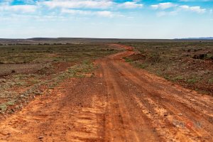
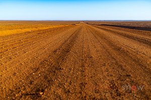
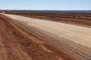
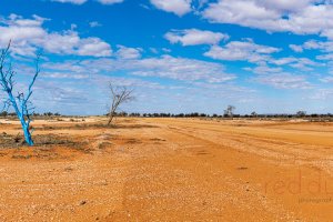
Beautiful morning light on the Thargomindah to Noccundra road; Corner Country, Outback NSW
Heading north along Willangee Rd travelling from Eldee Station to Border Downs Road. Corner Country, Outback NSW, Australia
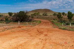
McDougals Hills road just past the intersection with Wilangee Road, heading north. Outback NSW, Australia
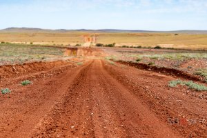
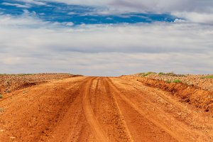
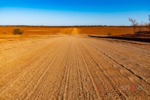
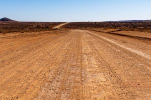
Shallow Depth of Field (DOF) photograph taken while travelling north along Corona Road (North of McDougalls Well Rd) heading to Border Downs, Corner Country, Outback NSW, Australia.
Shallow Depth of Field (DOF) photograph taken while travelling north along Corona Road (North of McDougalls Well Rd) heading to Border Downs, Corner Country, Outback NSW, Australia.
Heading east along Sanpah Rd from Border Downs towards Silver City Highway (South of Packsaddle), Corner Country, Outback NSW, Australia
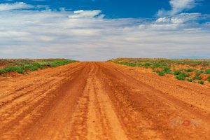
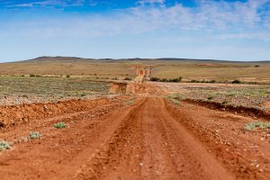
Travelling north along Corona Road (North of McDougalls Well Rd) heading to Border Downs, Corner Country, Outback NSW, Australia.
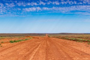
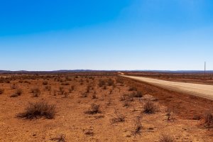
Heading west along Border Downs Rd from Corona Road towards the Dingo Fence (NSW / SA border), Corner Country, Outback NSW, Australia
Heading west along Border Downs Rd from Corona Road towards the Dingo Fence (NSW / SA border), Corner Country, Outback NSW, Australia
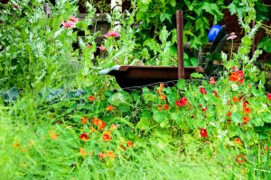
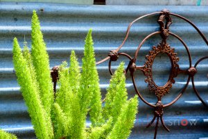
The spectacular garden of the Lake Paika homestead, Balranald, NSW
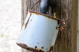
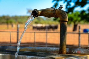
Homestead images of Lake Paika Station, Balranald, NSW
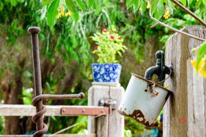
Homestead images of Lake Paika Station, Balranald, NSW

Homestead images of Lake Paika Station, Balranald, NSW
Homestead images of Lake Paika Station, Balranald, NSW
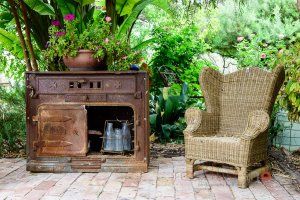
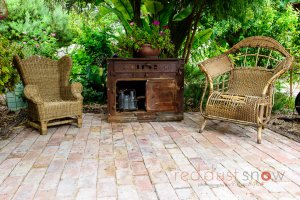
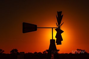
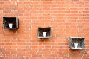
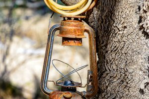
Wicker, steel and gardens at Lake Paika Station, Balranald, NSW
Homestead images of Lake Paika Station, Balranald, NSW
Homestead images of Lake Paika Station, Balranald, NSW
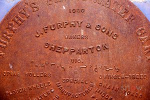
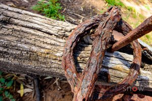
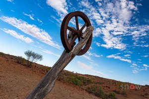
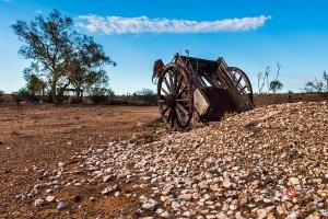
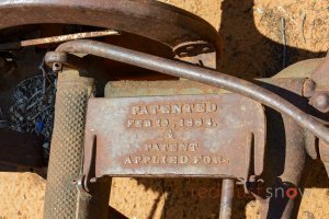
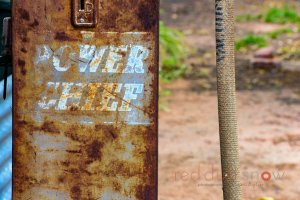
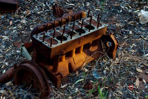
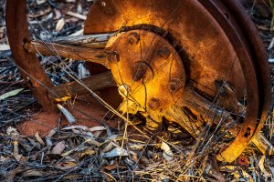
Old steel wheels at the Lake Paika Homestead. Balranald, NSW
Homestead images of Lake Paika Station, Balranald, NSW
Homestead images of Lake Paika Station, Balranald, NSW
Bindara on the Darling, Menindee, Outback NSW
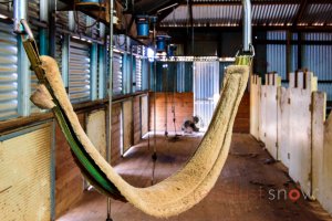
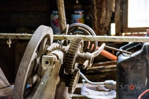
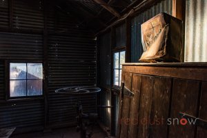
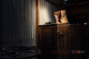
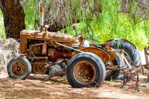
Inside the shearing shed, Goodwood Station, White Cliifs, Outback NSW
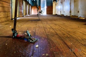
Inside the shearing shed, Goodwood Station, White Cliifs, Outback NSW

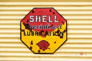
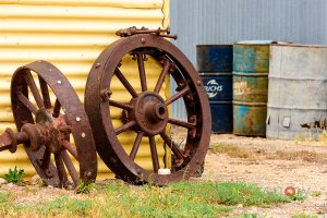
Goodwod Station, White Cliifs, Outback NSW
Goodwod Station, White Cliifs, Outback NSW
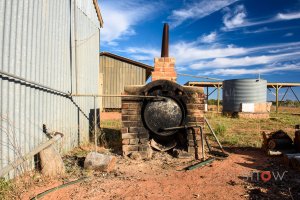
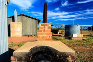
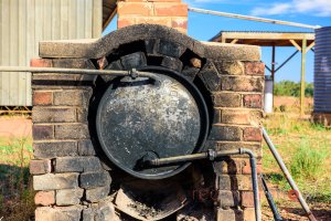
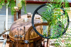
The pig (stove) at Goodwood Station, White Cliifs, Outback NSW
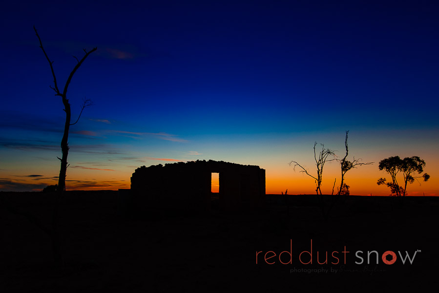
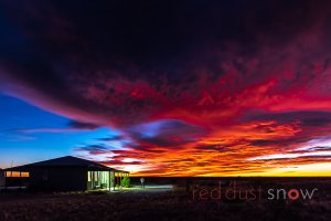
Sunset at Goodwood Station, White Cliifs, Outback NSW
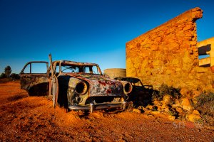
Morning light illuminates the old wreck near the Nevada Hotel ruins, Silverton, Outback NSW

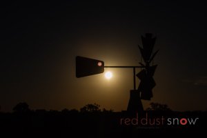
Full moon setting over the shearers quarters at Pimpara Lake Station, Outback NSW, Corner Country
A beautiful sunrise over the shearer's quarters at Pimpara Lake Station
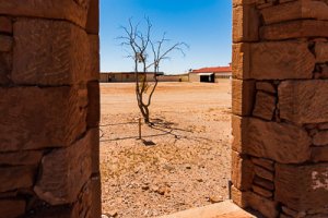
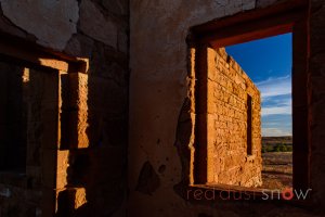
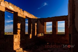
Commercial Bank ruins at Milparinka, Corner Country, Outback NSW
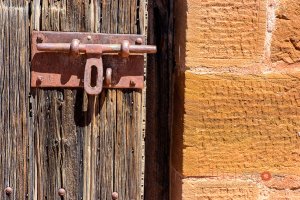
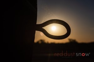
Milparinka Jail door, Corner Country, Outback NSW

Milparinka Jail door, Corner Country, Outback NSW
Milparinka Jail door, Corner Country, Outback NSW
Looking south along Mount Shannon Road from Milparinka. The road provides a great option when driving from Tibooburra to Broken Hill.
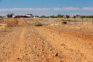
Roads Heading into Milparinka, Corner Country, Outback NSW
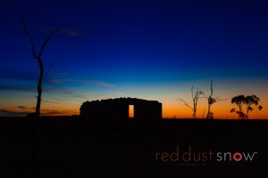
Sunset colors on the Baker Residence at Milparinka, Corner Country, Outback NSW
Sunset colors on the Baker Residence at Milparinka, Corner Country, Outback NSW
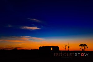
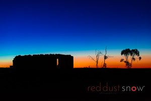
Sunset colors over the Commercial Bank at Milparinka, Corner Country, Outback NSW
Golden Gully Mining Site at Tibooburra, Corner Country, Outback NSW
Golden Gully Mining Site at Tibooburra, Corner Country, Outback NSW


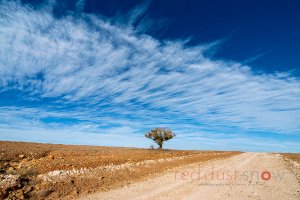
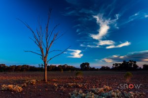
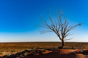
Iconic lone tree on the roadside between Bourke and Trilby Station, Outback NSW
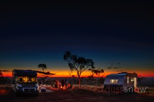
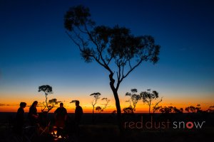
RV Camping on top of Mount Oxley, Bourke, Outback NSW
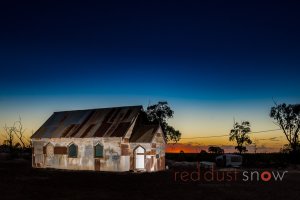
A sunset shot of the Goddess of '67 Church used in the movie starring Rose Byrne. Lightning Ridge, Outback NSW, Australia
Homestead images of Lake Paika Station, Balranald, NSW
Bindara on the Darling, Menindee, Outback NSW
Bindara on the Darling, Menindee, Outback NSW
Bindara on the Darling, Menindee, Outback NSW
Bindara on the Darling, Menindee, Outback NSW
Bindara on the Darling, Menindee, Outback NSW
Bindara on the Darling, Menindee, Outback NSW
Bindara on the Darling, Menindee, Outback NSW
Bindara on the Darling, Menindee, Outback NSW
Goodwod Station, White Cliifs, Outback NSW
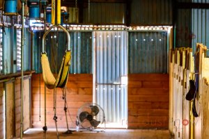
Inside the shearing shed, Goodwood Station, White Cliifs, Outback NSW
Sunset colors over the Commercial Bank at Milparinka, Corner Country, Outback NSW
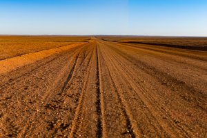
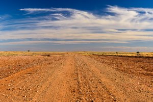
Driving Cameron Corner Road west from Tibooburra heading to Cameron Corner via Waka Claypan and Fort Grey. Corner Country, Outback NSW, Australia
The road across the Waka clay pan (heading west to Cameron Corner from Tibooburra, Outback NSW, Australia
The road across the Waka clay pan (heading west to Cameron Corner from Tibooburra, Outback NSW, Australia
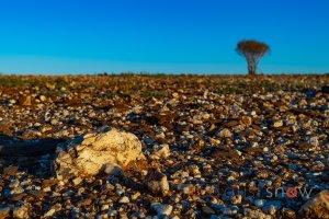
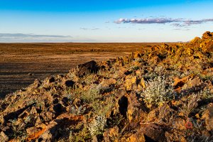
Morning light illuminates the quartz rock between Milparinka and Depot Glen, Outback NSW, Australia
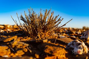
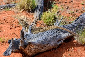
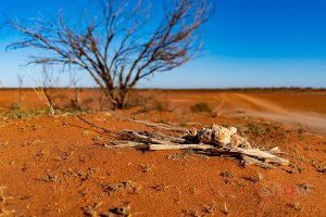
An old tuft of grass with the rocky landscape at Depot Glen, Outback NSW, Australia.
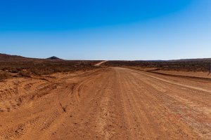
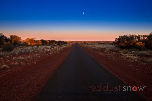
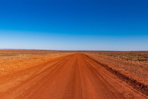
Corona Road heading to the Dingo Fence, north of Broken Hill, Corner Country, Outback NSW, Australia.
Corona Road heading to the Dingo Fence, north of Broken Hill, Corner Country, Outback NSW, Australia.
Corona Road heading to the Dingo Fence, north of Broken Hill, Corner Country, Outback NSW, Australia.
Corona Road heading to the Dingo Fence, north of Broken Hill, Corner Country, Outback NSW, Australia.
Heading south along Wilangee Road from Mount Woowoolahra towards Eldee Station, Corner Country, Outback NSW, Australia
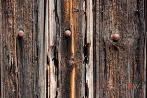
The textures and vistas of Packsaddle Hill, Outback NSW, Australia
The textures and vistas of Packsaddle Hill, Outback NSW, Australia
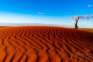
The textures and vistas of Packsaddle Hill, Outback NSW, Australia
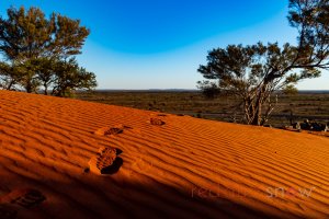
The textures and vistas of Packsaddle Hill, Outback NSW, Australia
The textures and vistas of Packsaddle Hill, Outback NSW, Australia
The textures and vistas of Packsaddle Hill, Outback NSW, Australia
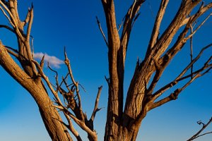
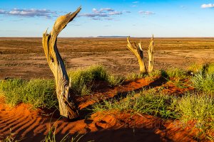
The Blue tree sighted beside Henry Roberts Rd when travelling south-west from Silver City Highway (north of Pack Saddle) to White Cliffs, Outback NSW, Australia.