Darling River Run Touring Route, Map & Guide
Your Ultimate 2026 Touring Guide
The Darling River Run is a 13-day, ~2,000 km self-drive touring route across Outback NSW, following Australia's longest river system from Lightning Ridge to the Murray–Darling junction at Wentworth. It's doable in almost any vehicle, accessible within a day's drive of the east-coast capitals, and takes in Broken Hill, the opal towns of White Cliffs and Lightning Ridge, historic river ports like Bourke, Louth and Tilpa, and World Heritage Lake Mungo.
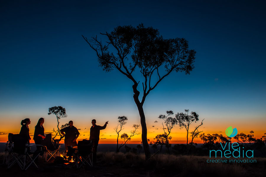
The Darling River Run is one of the best touring experiences in Australia. The route is an adventure across Outback NSW along the Darling River, Australia's most iconic waterway.
The tour along Australia's longest waterway (and tributaries) is not only about travelling the course of our iconic river but also throughout Outback NSW via the many side trips and travel routes. (Darling River Road Conditions)
The Darling River Run is regarded by many as one of Australia's best outback touring routes. While it might not be the extreme off-road that some seek, it is easily done in (almost) any vehicle and is easily accessible from any east-coast capital cities; less than a day's drive to get to the Darling River. (Camping & 4WD)
Wondering when is the best time to drive along the Darling?
It is a driving adventure where you can experience the richness of indigenous history & culture, learn about our pastoral pioneers and their 'life on the land' and experience the laid-back nature and country hospitality of the outback towns along the river.
My Top Five Tips for the Darling River Run
Having travelled the Darling River many times over the years, I would like to share my preferred route, encompassing some of the best experiences, destinations, and attractions. While on the road, fellow travellers often ask me what my top five tips are for travelling the Darling River Run.
- Visit Broken Hill, the capital of Far West NSW.
- Experience Australian opal by visiting White Cliffs and Lightning Ridge.
- Bourke, Louth, and Tilpa will give you an insight into what the outback is all about. Henry Lawson spent significant time working around the central Darling and put this understanding into words.
- Head out to Cameron Corner as part of a return trip linking Bourke – Tibooburra – Broken Hill (and Menindee).
- Do the Watershed Loop to gain an understanding of the transitioning landscapes of the Murray–Darling Basin and the Lake Frome Basin (Lake Eyre).*
Itinerary
With the Ridge as the starting point, it is time to experience a place that is genuinely a 'must-see' icon of the outback. Allow three days to experience the Ridge; the Grawin can be experienced on the drive from Lightning Ridge to Brewarrina.
** Be sure to check the river levels of the Darling River before heading out on your adventure!
Home of the elusive Black Opal, Lightning Ridge is one of the most unique destinations in Australia, and such is the allure of 'the Ridge' that many who initially planned to only stay a day or so as part of a larger travel experience, end up staying a lifetime without being able to pinpoint the exact reason.
Day 1 — Lightning Ridge to Bourke
Route Overview
There are two options for the Ridge to Brewarrina section of the Darling River Run: via Walgett along Bill O'Brien Way and then the Kamilaroi Highway (straight and not the most exciting), or, for one of the best experiences in all of Outback NSW, the drive via the Grawin Opal Fields for a unique experience of the original opal fields (before the Ridge). This option can include a lunch break at the 'Club in the Scrub', Sheep Yard Flat, or the Glengarry Hilton.
The Brewarrina to Bourke section of the Darling River Run is an easy drive along the Kamilaroi Highway with little access to the river. A better optional route is north of the Darling River, which heads back along the Kamilaroi Highway, then northwest along Twin Rivers Road to West Culgoa Road.
West Culgoa Road follows the path of the Culgoa River southwest to the Mitchell Highway; then it is a short 5 km to Kidman's Camp (or about 15 km into Bourke itself). The Culgoa River joins the Darling River about 25 km east of Bourke.
Road / Route (295* km)
- Via the Grawin (to Brewarrina): 164* km — Preferred / Adventure Route
- Llanillo Rd <> Wilby Wilby Rd <> Grawin <> Narran Lake Rd <> Goodooga Rd
- Gravel (dry weather road)
- Via Walgett (to Brewarrina): 212 km
- Castlereagh Highway, sealed road
- Brewarrina to Kidman's Camp (Nth Bourke): 131* km
- Kamilaroi Hwy/B76 <> Goodooga Rd <> Twin Rivers Rd <> West Culgoa Rd <> Mitchell Highway
- Gravel (dry weather road)
Meals & Provisions
- Lightning Ridge
- The Grawin (3 Pubs)
- Brewarrina
Towns, Parks & Localities
The Grawin Opal Fields
If you think the Ridge is unique, head out to the Grawin; the opal fields where it all began. Not a town, the Grawin is full of memorable welcoming characters living in a landscape that often resembles a moonscape.
Located about 40 km from the Ridge, it is a fascinating place to visit and experience Grawin hospitality at one (or all) licensed premises. The Club in the Scrub, Glengarry Hilton, and Sheep Yard Flat are unique names. The Grawin refers to the group of opal fields made up of Grawin, Glengarry, Sheepyard, and Mulga Rush.
Opal was first discovered in the region in 1905 by Charles Phipp while working at Morendah Station (a few km to the east of Grawin). Still, little mining was carried out there at the time.
About Brewarrina
Brewarrina provides the visitor with an insight into the significance of the Darling River to indigenous history and living culture. Near the town centre are the Fish Traps, an ancient arrangement of rocks that corral fish for catching.
About Walgett
Walgett, located by the Namoi River near its junction with the Barwon River in northern NSW, is the service centre for the surrounding wool, beef cattle, sheep, and wheat pastoral interests.
Day 2 — Experience Bourke
Bourke is a thriving service town and a mecca for travellers, due in part to its location at the crossroads of the north–south and east–west routes of outback NSW, but more importantly due to the efforts of the town to provide an ever-increasing number of experiences on offer; experiences that showcase the town's history and the unique place it holds as a river port on one of our most iconic rivers.
The jewel in the crown for Bourke is the Back O' Bourke Exhibition Centre, a world-class facility with interactive installations and stunning visual displays covering the Indigenous and European history of the region. It would have to be one of the best of its type in Australia.
Bourke Accommodation
- Kidman's Camp (RV and Cabin Accommodation)
Day 3 — Drive Bourke to Louth
Route Overview
The eastern route, past Gundabooka National Park, is more popular and the best maintained, providing excellent access to the highlights of Gundabooka NP. While the western side of the Darling River is the longer route, it is much more scenic with a variety of landscapes and the opportunity to visit Toorale National Park and cross over the Warrego River, an ephemeral tributary of the Darling that originates in central Outback Queensland. The Warrego will only flow into the Darling during an exceptionally high flow.
Be sure to cross the river to visit Louth for a lunch break (Shindy's Inn) and look around. ** Be sure to cross back over the river before heading downstream to Dunlop Station.
Road / Route (142* km)
Western Route — Preferred / Adventure Route
- Mitchell Hwy/B71
- Hungerford Rd
- Bourke–Milparinka Rd
- Toorale Rd (unsealed)
- Gravel (dry weather road)
Meals & Provisions
- Bourke (Food, Fuel, Provisions, Pubs, Repairs)
- Louth (Pub, Fuel, Meals)
Towns, Parks & Localities
About Louth
Louth established itself as a service point for the Cobb & Co coaches and as a Darling River port, becoming a pivotal river port. Louth's founder, T.A. Matthews, founded a hotel and general store to service the booming river trade and Cobb & Co.
Day 4 — Experience Dunlop Station
Step back in time at historic Dunlop Station, 14 km downriver from Louth on the western side of the river. Originally over a million acres, Dunlop's main claim to fame is that it was the first shed in the world to complete a mechanical shearing, back in 1888.
The Chandler family offer guided tours of the original stone homestead, the 45-stand shearing shed and the station store, dating back to the 1880s, from 11 am Wednesday through Sunday (closed Monday and Tuesday). The tour costs $15 pp and $40 per family, including morning tea. Peaceful river campsites are also available.
Day 5 — Dunlop Station to Kallara Station
Route Overview
Heading into the Central Darling area, the middle section of the Darling River Run covers the more remote and outback areas of the riverplain, including the ephemeral Paroo River, which joins the Darling River (only during very high/sustained flows) just upstream of Wilcannia. A short section, with either side of the river as good as the other.
If the eastern route is the choice, head upstream to Louth (after crossing the river), then down the east side before crossing back over the river at Tilpa (on the western bank) before heading back upstream to Kallara Station (about 15 minutes' drive). The eastern side of the Darling River also allows stopping at the Tilpa Weir, about 10 km upstream from Tilpa.
The preferred western route will get you to Kallara Station quicker, and visiting Tilpa pub can be done on the trip to Wilcannia (a perfect lunch break).
Road / Route (56* km)
Dunlop Station to Kallara Station (western route)
- Bourke–Wilcannia Road
- Gravel (dry weather road)
Meals & Provisions
Depending on your route, Tilpa Pub is a short drive from Kallara Station if taking the western route.
Towns, Parks & Localities
About Tilpa
Located on the western banks of the Darling River, the very welcoming town of Tilpa is a must for a stopover, whether you have a few hours or a few days for camping and fishing on the Darling River.
The old pub is a true classic and has welcomed travellers and locals for over 100 years. The pub's walls are covered with graffiti written by visitors who donate gold coins to the Royal Flying Doctor Service for the privilege. The graffiti makes for an intriguing read while having a cold beer and chatting with the locals and other fellow travellers.
Day 6 — Drive Tilpa to White Cliffs
Route Overview
The route for the day is along the eastern side of the Darling River, after a visit (or lunch) at the iconic Tilpa Pub, to Wilcannia, and then out to the opal town of White Cliffs.
After lunch and signing the wall (if you can find a spot), it is time to cross the river and head downstream along the eastern bank through Paroo-Darling National Park — even a stop at the Coaches & Horses campground, right on the river, to break the drive up a bit — then into Wilcannia.
The drive to White Cliffs is all on a sealed road.
Road / Route (234* km)
- Kallara Station to Wilcannia
- Tilpa–Louth Rd
- East Tilpa Rd
- Barrier Highway
- Gravel (dry weather road)
- Wilcannia to White Cliffs
- Barrier Highway
- Opal Miners Way
Meals & Provisions
- Tilpa Pub (Meals and Fuel)
- Wilcannia (Fuel, supermarket, vehicle repairs)
- White Cliffs General Store
- White Cliffs Hotel
Day 7 — Drive White Cliffs to Nelia Gaari Station
Route Overview
Never a fan of backtracking on a route, but the trip to White Cliffs and a stay at the White Cliffs pub make it worthwhile. Well rested, it is time to head back along the Opal Miner's Way to Wilcannia and then down the western side of the Darling River to Nelia Gaari Station.
NOTE: There is no river crossing at Nelia Gaari, so the only way in is via the western side. The only river crossing downstream is at Menindee, over an hour's drive away.
Road / Route (179* km)
- White Cliffs to Nelia Gaari Station
- NOTE: Nelia Gaari is only accessible from the western route (no river crossing).
- Opal Miner's Way
- Barrier Hwy/A32
- West Wilcannia Rd (unsealed road)
Meals & Provisions
- White Cliffs (Meals, fuel, general store)
- Wilcannia (Fuel, supermarket, vehicle repairs)
Towns, Parks & Localities
About Wilcannia
Located where the Barrier Highway crosses the Darling River, Wilcannia is a largely undisturbed port on the Darling River. Cross the bridge driving from Sydney to Broken Hill and turn either right or left as you enter the town, and you will be amazed at the richness of the architecture.
Day 8 — Drive Nelia Gaari (Menindee) to Broken Hill
Route Overview
With over half of the Darling River Run completed, it is time to hit the big smoke and refresh at the most iconic inland city in Australia, Broken Hill.
Broken Hill is an icon of Outback Australia, sitting on an iron-rich red landscape under a big azure sky — distinctive colours and contrasts that are synonymous with Australia's Corner Country (where the real outback begins).
Broken Hill's name conjures up so much that we identify with Australia. Henry Lawson once stated, "if you know Bourke, you know Australia," an adage that could apply equally to Broken Hill as it does to Bourke (but with a slightly more modern context).
Road / Route (170* km)
- Nelia Gaari Station (Menindee) to Broken Hill
- West Wilcannia Road (unsealed)
- Menindee Road
- Barrier Highway
Meals & Provisions
- Menindee (Fuel, Meals, Repairs, General store)
- Broken Hill (Pretty much everything)
Towns, Parks & Localities
About Menindee & Menindee Lakes
Menindee and the surrounding area is a region of legends and great history; the area is of great indigenous significance and European pastoral history. The area is known to the Barkindji people as 'Minandichee', regarded as the origin of the town's name.
About Kinchega NP
Located within a few kilometres of Menindee, Kinchega National Park provides lovely access to the Darling River for river camping and fishing and is rich in indigenous and pastoral history.
Day 9 — Experience Broken Hill
No trip to Outback NSW would be complete without visiting Broken Hill, the Silver City, and it is only a short drive (115 km) from Menindee along Menindee Road (sealed).
Broken Hill is a true icon of Outback Australia, sitting on an iron-rich red landscape under a big azure sky — remarkable colours and contrasts that are synonymous with Australia's Corner Country (the area radiating out from Cameron Corner, the place where the states of NSW, QLD and SA meet).
Henry Lawson once stated "if you know Bourke, you know Australia," an adage that could apply equally to Broken Hill. While Bourke grew out of the river trade, Broken Hill grew out of mining and iron and is where the Big Australian (BHP) was born. The Heritage-Listed city has a big history with wonderful attractions and unique experiences.
Broken Hill (also known as 'The Silver City') is one destination that should be on any travel list. Not only is it a beautiful town with wonderful architecture (and of course people), it also provides the perfect base for exploring some of the best attractions in this region of Australia. While over an hour from Menindee and the Darling River, Broken Hill is a must-see while travelling the Darling River Run, as well as up to the Corner Country towns like Milparinka, Tibooburra, and across to Cameron Corner.
Nearby
About Silverton
Few outback places are as iconically outback Australia as Silverton, and visitors come from far and wide to this little town on the edge of the real outback. Silverton was once a thriving mining town, later a ghost town, only to re-invent itself as a lively destination of museums, art galleries, and unique cafes and gift shops. Add to that a VERY iconic pub adorned with images of films made in the area, including Mad Max with Mel Gibson.
Day 10 — Broken Hill to Bindara Station (Menindee)
Route Overview
Rested and revived after staying in Broken Hill, it is time to head back to Menindee to explore the town and lakes before heading to Bindara Station, an icon of the lower Darling River.
The road to Menindee is bitumen, while the route from Menindee through Kinchega National Park is the start of the unsealed road. Be sure to get a visitors' guide for what to see and do in Kinchega National Park. Kinchega provides the best access to the Darling River of all parks along the Darling River Run.
Road / Route (208* km)
Broken Hill to Bindara Station via Menindee / Kinchega NP
- Barrier Highway
- Menindee Rd
- Old Pooncarie Rd
Meals & Provisions
- Broken Hill (Pretty much everything)
- Menindee (Fuel, Meals, Repairs, General store)
Towns, Parks & Localities
About Kinchega National Park
Kinchega National Park, located in the central Darling about one hour southeast of Broken Hill, provides terrific access to the Darling River for birdwatching, historical insights, river camping, and fishing. Rich in indigenous and pastoral history, bounded by the Darling River and upstream from Menindee Lakes, Kinchega NP is a must-see locality.
About Menindee & Menindee Lakes
Menindee and the surrounding area are the stuff of legend and history; the region has rich indigenous significance and European pastoral history. The area is known to the Barkindji people as 'Minandichee', believed to be the origin of the town's name.
Day 11 — Menindee to Lake Mungo
Route Overview
Continuing south along the western bank of the Darling River, the next stop is the beautiful hamlet of Pooncarie, an excellent place for lunch down by the river and even some memento shopping at the great little gift shop. From Pooncarie the route heads west to Lake Mungo (Mungo National Park) for a unique experience and insights into First Nation history and a bit of European history. Allow a full-day visit to explore Lake Mungo National Park.
Road / Route (183* km)
- Bindara Station to Lake Mungo NP
- Old Pooncarie Rd <> Polia Rd (unsealed)
- Pooncarie Rd
- Top Hut Rd (unsealed)
Meals & Provisions
- Pooncarie (Fuel, Meals, General store)
- Mungo Lodge (Meals and Accommodation)
Towns, Parks & Localities
About Pooncarie
The area, known initially as 'Pooncaira', came into existence during the 1940s as European settlers took up illegal livestock runs on crown land; by the 1960s the Federal Government took control of the area by formalising the illegal land claims.
About Lake Mungo
In theory, Lake Mungo is little more than the remnants of an ancient dry lake with a twenty-kilometre dune ridge formed on one side, but in reality it is one of the most significant anthropological and archaeological sites in the world. Mungo exhibits 40,000+ years of continuous human habitation.
Day 12 — Experience Lake Mungo NP
Welcome to Mungo National Park! While today may not involve driving, there are plenty of exciting activities to keep you engaged. At Mungo Lodge you have the option to relax and indulge in some pampering. However, if you're up for exploration, Mungo National Park offers a captivating experience.
Nestled in the heart of the New South Wales outback, Lake Mungo National Park may seem like nothing more than the remnants of an ancient lake with dry expanses and ancient sand dunes stretching over twenty kilometres. But in reality it holds immense anthropological and archaeological significance, making it one of the most remarkable sites in the world.
One must-see attraction for all visitors is the renowned 'Walls of China.' This iconic formation not only exhibits stunning natural beauty but also carries profound spiritual importance. Designated as a World Heritage site, Lake Mungo boasts evidence of continuous human habitation spanning over 40,000 years. It is part of the larger Willandra Lakes World Heritage Area, comprising seventeen dry lakes.
Over countless years, the awe-inspiring Walls of China emerged as winds swept across the desiccated lake bed, gradually depositing sediment on the western shore. This accumulation formed an elevated bank that stretches nearly 20 kilometres along the lake's side. Through wind and rain erosion, the layers of sedimentary sands and clays have shaped a spectacular lunette, offering breathtaking photography opportunities amidst the shifting light.
While the lakes last held permanent water over 10,000 years ago, they once teemed with life. Aboriginal people gathered mussels, fished for Murray cod and golden perch, hunted wallabies and rat kangaroos, and collected emu eggs. Evidence of their activities can still be found in ancient fireplaces, indigenous burial sites, and fossilised remains of extinct species like the short-faced kangaroo.
The park also offers glimpses into its European past. Before becoming a national park, Mungo served as an operational sheep station, and remnants of heritage buildings from that era still dot the landscape. Conveniently located just over an hour's drive from Wentworth and approximately an hour from the Darling River near Pooncarie, Mungo National Park is easily accessible. For the best experience, plan your visit during autumn, winter, or spring, when you can avoid the extreme summer heat and fully appreciate the park's wonders.
Day 13 — Lake Mungo to Wentworth
Route Overview
It's hard to believe, but the Murray–Darling confluence is a little over an hour's drive away, with so much already explored and experienced. But it isn't over yet!
The last leg of the adventure includes an excellent accommodation option at the end of your Darling River Run. Lake Paika Station is an apt way to finish your journey, a place to put your feet up, reflect, and enjoy some great hospitality. Visit Wentworth, then head across to Lake Paika — perfect for those who have not been to see where the Darling River joins the Murray River.
Road / Route (135* km)
Lake Mungo <> Wentworth
- Arumpo Rd
- Silver City Hwy
Meals & Provisions
- Wentworth (Meals, Fuel, Supermarket, Pubs)
Towns, Parks & Localities
About Wentworth
Wentworth, NSW — a place that, in 1844, was described as "Magnificent trees droop like willows to the water's edge with evening's mildest radiance in their foliage, throwing a soft haze over the distance…" — has lost nothing of that ethereal beauty and has to be a place to visit.
Frequently Asked Questions
How long does the Darling River Run take?
Allow at least 13 days to drive the Darling River Run comfortably from Lightning Ridge to Wentworth, including rest days at the Ridge, Broken Hill and Lake Mungo. You can do it faster, but the side trips, river ports and national parks reward a slower pace.
Do I need a 4WD for the Darling River Run?
No. The Darling River Run is easily done in almost any vehicle in dry conditions. Many sections are gravel "dry weather roads," so check road conditions and river levels before you go and avoid unsealed sections after rain. A high-clearance vehicle or 4WD adds flexibility for the more scenic western routes.
When is the best time to drive the Darling River Run?
Autumn, winter and spring are best, when you avoid the extreme summer heat of Outback NSW. Always check the Darling River water levels and road conditions before heading out, as unsealed roads can close after rain.
Where does the Darling River Run start and finish?
This guide starts at Lightning Ridge in northern NSW and finishes at Wentworth, where the Darling River joins the Murray River. The route passes through Bourke, Louth, Tilpa, Wilcannia, White Cliffs, Broken Hill, Menindee and Lake Mungo along the way.
How long is the Darling River Run in kilometres?
Following the preferred route in this guide, the Darling River Run covers roughly 2,000 km across Outback NSW, depending on the side trips and the western or eastern bank options you choose for each leg.
Plan Your Darling River Run
Fifteen years of chasing light across Outback NSW have gone into this guide. If you're planning your own Darling River Run, explore the detailed river guides, or browse and license outback imagery from the journey.