The Timber Cutters Run: A Journey Through History and Nature
Murray River Driving Routes
Welcome to the Timber Cutter's Runtm, a unique touring route along ancient waterways and through ethereal forests. This driving route is not just another tourism hidden gem but the real deal. It reveals a story of an earthquake 60,000 years ago, the Cadell Fault, the Narrows (Barmah Choke), a 50 km sandridge, the redirection of the Murray River, and the creation of the Millawa-Barmah forests - the largest stand of River Red Gum in the world.
With more and more development along the Murray River, there are fewer and fewer places that remain relatively untouched, enabling visitors to experience real nature.
The Timber Cutter's Run extends from Echuca/Moama past Barmah, Mathoura, Deniliquin, Moulameim and Kayalite before heading north to Balranald.
Located within the Central Murray River Catchment, the Timber Cutters Run follows the Murray River, Gulpa Creek, Edward River, Wakool River, and the Niemur River.
We respectfully acknowledge that the Yorta Yorta, Perrepa Perrepa, and Wamba Wamba people are the traditional custodians of this area of the Central Murray and so pay our respect to their elders, past and present.
What is the Cadell Fault
The Cadell Fault
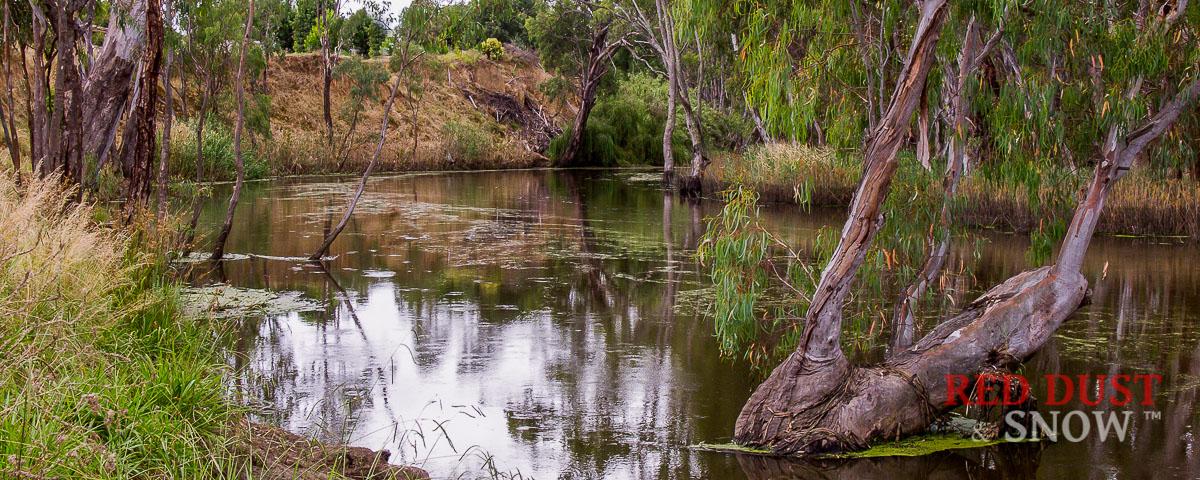 The Cadell Fault beside the Gulpa Creek at Mathoura, New South Wales, Australia
Around 60,000 years ago, a seismic event changed the course of the Murray River; it is considered one of the world's most spectacular, altering the course of a river. While it may seem a long time in the past, it is good to put it into the context of Australian history that Indigenous history reaches further back (65,000 years for the earliest evidence of humans in Australia).
Research reveals that several sizable earthquakes lifted the land between Echuca and Delinquin east of present-day Cobb Highway (The Long Paddock touring route).
The findings summarised that the original course of the Murray River was west through present-day Mathoura via Green Gulley, a watercourse still visible today. In fact, after heavy rain, Green Gulley is filled with water that flows from the original watercourse of the Murray River.
Slideshow - Cadell Fault and its effect on the Murray River
Effect on the Waterways
The Waterways
- Around 60,000 years ago, a seismic event changed the course of the Murray River; it is considered one of the world's most spectacular, altering the course of a river. While it may seem a long time in the past, it is good to put it into the context of Australian history in that Indigenous history reaches further back into history. (65,000 years for the earliest evidence of humans in Australia).
- Research reveals that several sizable earthquakes lifted the land between Echuca and Delinquin east of present-day Cobb Highway (The Long Paddock touring route).
The findings summarised that the original course of the Murray River was west through present-day Mathoura through a watercourse known as Green Gulley, which is still visible today and is filled with water during heavy floods. - The main fault line between Moama and Deniliquin is over 50km long and is up to 12–15 metres in height.
- The Green Gully course joined the Edward/Wakool River near Wakool (west of Mathoura) and flowed to the present Murray River west of Kayalite.
- This suggested course meant the Murray River did not flow via Echuca and onto Swan Hill. The Goulburn River flowed to Echuca, then on to meet the Murray River near Kayalite.
- When the tilt/fault occurred, this dammed both waterways to form two large lakes:
- The Northern Lake (between Mathoura and Barmah)
- Lake Kanyapella (between Barmah and Moama)
- Around 20,000 years ago, with the need to find a new course, the Murray River turned north, creating the Edward River, to present-day Deniliquin before heading west (Moulamein) and joining the present course west of Kayalite while also continuing to fill the Northern Lake.
- The Goulburn, with the southern-sourced Campaspe River, formed Lake Kanyapella.
- The flow of the Murray River into Northern Lake deposited silt protrusions (also known as silt-jetties) through the lake, which became the modern course of the Murray River; this course created a narrower river today known as the narrows or choke.
- The Murray River also created a new course to the southwest via the 'Narrows' (the Barmah Choke), to follow its current path created by the ancient Goulburn River, to Swan Hill.
Effect on the Landscape
The Landscape
- Back when this was happening, the landscape was very different from the forests we see today and evidence reveals it a more open woodland and grassy plains including tree ferns. The actual red-gum forest is relatively new, forming around 6,000 years ago.
- The Murray's flow was much greater than today as glaciers covered the ranges around Mount Kosciuszko (20,000+ years ago) and the melt provided a constant supply of water.
- During a severe drought, the Northern Lake Dried and prevailing winds blew the sand sediment from the lake and created the sand ridge that runs along Picnic Point Road and the sandhills around the now-named Sand Range woodlands.
- During the same dry period, Lake Kanyapella also dried and created the sandhills around Barmah, visible along the Barmah road that leads from the Cobb Highway.
- With the ebb and flow of floods, the native grasses flourished. Still, the original trees were not suited to the constant wet. this provided a natural opportunity for different tree species to grow, and species like the River Red Gum (Eucalyptus camaldulensis) created the upper canopy while native grasses, sedges and rushes thrived on the ground story.
- Legend of the First Nation people, the Yorta Yorta, tells a story that ancestors, when the Cadell tilt dammed the water during a great flood, helped the river through by digging through a sand ridge and enabled the current course of the Murray River.
- The narrows (Barmah Choke) that were created in the Northern Lake and formed the modern course of the Murray are (surprisingly) dated at only 500-600 years. This section of the river exhibits straight-sided banks, which is out of character for the Murray River.
- The Barmah Choke restricted the river's flow and created the perfect conditions for the Barmah forest to form and establish itself as the world's largest River Run Gum forest.
The Gulpa Creek was diverted north due to the fault line and joined the Edward River about 20 km south of Deniliquin. - The Edward River came into being as a result of the Murray River building up as a result of the Cadell tilt and needing a new course, and the resultant waterway rejoined the Murray River southwest of Balranald.
- The Goulbourn River is believed to have been the main waterway to Echuca and then followed the same course as today's Murray River, the exception being that it was not linked to the original route of the Murray via Mathoura/Green Gulley, which ended up flowing north to Deniliquin then west as the Edward River.
Touring Route Introduction
The Timber Cutters RunTM is a touring route through the central Murray Catchment of the Murray-Darling Basin from Moama to Balranald, visiting Barmah, Mathoura, Deniliquin, Moulamein, and Kayalite along the way.
This adventure reveals a story of an earthquake 60,000 years ago that caused the redirection of the Murray River, the creation of two ancient lakes, and the formation of the Barmah Forest.
The Barmah-Millewa forest is the largest stand of River Red Gum in the world.
This earthquake created the Cadell Fault/Tilt. This elevated ridge stretches from Moama to Deniliquin, much of which this tour will follow, with the section from Deniliquin to Kyalite following the Edward and Wakool Rivers.
If doing the Long Paddock touring route from Moama to Wilcannia, this touring route is an excellent alternative to the Moama-Deniliquin section. It does not bypass any of the waypoints of that route.
Touring Route Detail:
- Total Distance: Full Route: 358 km
- Road Surface: Mostly unsealed but well maintained - Bitumen alternative routes
- Vehicle Recommendation: AWD/4WD SUV with good clearance. Camper trailers & small-medium offroad caravans
- Communications: Good Mobile coverage on Telstra and Optus
- Food & Provisions: Moama, Mathoura, Deniliquin, Moulamein, Balranald
Timber Cutter's Run - Route Sections
The southern terminus of the Timber Cutters Run is Moama on the Victoria/New South Wales border. Just across the Murray River from Echuca, both form the twin towns known as Echuca-Moama and are located about 230 km north of Melbourne.
Moama is on the 'quiet side of the river' and lends itself to a more relaxed pace than Echuca, but provides effortless access to all the highlights of Echuca, and adds some of its own unique experiences.
Moama - Barmah
Echuca/Moama to Barmah
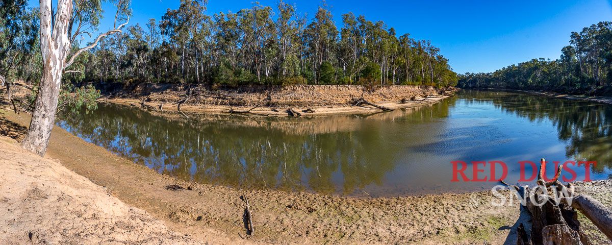 The Goulburn River and Murray River junction near Echuca, NSW, Australia
Touring Route Description
The start/finish point of the Timber Cutters RunTM is Echuca/Moama, with the first leg to Barmah following the Murray River along the Victorian side of the river from Echuca to Barmah with some beautiful river vistas along the way.
This route crosses the Goulburn River, a tributary of the Murray, which is sourced from Woods Point and the Victorian High Country and is believed to be the original course of the Murray River before the events that caused the Cadel tilt.
There is also an opportunity to see where the Goulburn River joins the Murray River, but large caravans are not advised on this track as there is little room to turn around. It is an easy walk from the main road, though.
It is a worthwhile experience to see where the ancient Goulburn River joins the Murray River and consider that upstream to Mathoura is a relatively new waterway.
Touring Route Details:
| Road/Track | Distance (km) | Cumulative (km) | Turn | Road Type |
| Goulburn Road | 2.20 | 2.20 | Right | Sealed |
| Bangerang Road | 7.25 | 9.45 | Left | Sealed |
| Stewarts Bridge Road | 22.50 | 31.95 | Left | Gravel |
| Barmah-Shepparton Road | 5.96 | 37.91 | Sealed |
About Barmah
About Barmah:
Trivia Time: Barmah is the only Victorian town north of the Murray River. (due to the winding nature of the river, this section has Victoria to the north of the river.)
Barmah is a small Murray River town known as the gateway to the superb Barmah National Park, home to the largest stand of red gum trees in the world. The red gum forest and the appeal of the Murray River are central to the attractions in the area.
The town's name is thought to come from a Yorta Yorta word 'Paama' meaning 'meeting place'.
In 1863-64, the railway line from Bendigo to Echuca was built and consumed large volumes of sleepers cut from the red gums in the Barmah forest. A punt began operation, joining the tracks from Echuca to Yarrawonga, where they crossed the Murray River. In 188,6 a town was surveyed on elevated ground near the punt, and the resulting Barmah village became a river outlet for wool from surrounding pastoral stations. It also became the shipping point for railway sleepers cut for domestic use and exported to India and New Zealand.
By the 1950s, there was evidence that the weirs built on the Murray River for irrigation were decreasing the flood frequency in the Barmah forest. The change of rhythm reduced the germination of red gum seedlings and interfered with the breeding of water birds. Effluent from human and farm activity also adversely affected water quality. Flood regulators were installed by 1959.
The Barmah National Park covers 28,500 hectares and forms the world's largest River Red Gum forest with the adjoining Murray Valley National Park in New South Wales. The complex ecology of the forest is possible due to the Murray River and its flooding regime that has created a diverse natural habitat for various wildlife, especially waterbirds.
Internationally recognised and listed under the Ramsar Convention, the wetlands of forest represent all of the four freshwater wetland types in Victoria. The forest provides a critical habitat for over 200 recorded species of birds, with Brolgas, Night Herons, Spoonbills, Sea Eagles, and Azure Kingfishers seen in the Park. River Red Gums line the Murray River for most of its length.
The iconic River Run Gums can reach 45 metres and live for over 500 years. The trees need periods of flooding and can survive inundation for months. Their seeds are washed onto the higher ground during a flood, germinating and growing before the next deluge reaches them. Hollows and broken branches provide nesting for Galahs, Cockatoos, Cockatiels and various Parrots, while fallen branches offer habitat for other animals.
Barmah - Mathoura
Barmah to Mathoura
Now, the real fun begins!
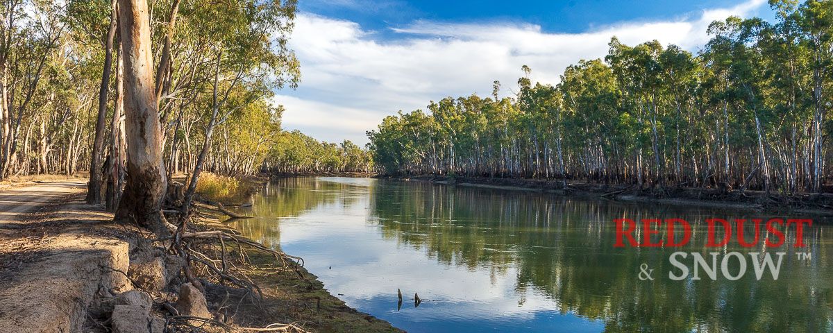 The Murray River along Barmah River Road, Barmah, Victoria, Australia
Touring Route Description
The journey from Barmah to Mathoura (Picnic Point) follows the Murray River (on the NSW side of the river) through the Murray Valley National Park (Moria section) with excellent access to the river along well-maintained tracks through the forest.
Touring Route Details:
The River Road follows the river until Moira Creek Road (a right turn), which proceeds up to Moira Lake and westward along the Millewa irrigation channel. There is no route along the Murray River north between Moira Lake and Barmah Lake; hence, there is a need to go around Moira Lake to the west.
Once around the lake, Swifts Creek Road heads east back to the Murray River and Swifts Creek campground. Similar to the south of the lakes, vehicle access to the lakes along the Murray River is not possible, but from the north, it is possible to reach the lakes via a walking trail.
| Road/Track | Distance (km) | Cumulative (km) | Turn | Road Type |
| Barmah Road | 1.00 | 1.00 | Right | Sealed |
| Barmah River Road | 7.50 | 8.50 | Right | Gravel |
| Moria Creek Road | 7.40 | 15.90 | Left | Gravel |
| Dora Creek Road | 1.60 | 17.50 | Right | Gravel |
| Algeboia Road | 0.90 | 18.40 | Right | Gravel |
| Dora Road | 4.00 | 22.40 | Left/Merge | Gravel |
| Coolamon Road | 4.30 | 26.70 | Right | Gravel |
| Swifts Creek Road | 3.90 | 30.60 | Right | Gravel |
| Hut Road | 7.60 | 38.20 | Right/Merge | Gravel |
| Poverty Point Road | 2.70 | 40.90 | Right | Sealed |
| Picnic Point Road | 1.00 | 41.90 | Sealed |
From Swifts Creek campground, the route heads north towards Picnic Point, with lovely vistas of the Murray River.
The Murray Valley National Park:
In 201,0 the Millewa, Gulpa and Moira State Forest was converted into a National Park, now referred to as the Murray Valley National Park. The well-known names are used for each section:
- The Moira Section: Barmah to just north of Gulpa Creek, with the Cobb Highway being the western boundary and Murray River the east boundary.
- The Millewa Section: From the Edward River in the west, running along with the Murray to the west of Tocumwal)
- Gulpa Island Section: Bounded by the Gulpa Creek and Edward River.
About Mathoura
About Mathoura
Mathoura is an integral part of the Long Paddock touring route that retraces a historic cattle run from Moama (just over the Murray River from Echuca) through Deniliquin, Hay, Ivanhoe and Wilcannia.
Along the way - at Moama, Mathoura, Deniliquin, Pretty Pine, Wanganella/Boorooban, Hay, and Ivanhoe - are various sculptures depicting the history of the route; in addition to interpretive signs to learn more about this iconic stock route.
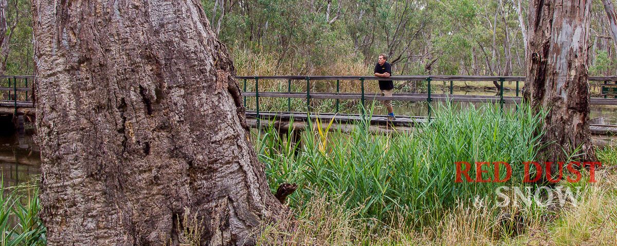 Walking one of the many walking trails around Mathoura, NSW.
Mathoura began as a market garden and a pub on a drovers track (part of the Long Paddock) in the mid-1800s and built itself as a timber source for the developing young nation of Australia. Not surprisingly, timber has remained an economic mainstay of the area ever since the woodcutters first arrived in the 1850s. The Red Gum timber is used for railway sleepers, furniture, landscaping, firewood, fence posts, and much more.
Mathoura is one of the best places to experience all the forests and rivers offer. The town of Mathoura grew out of a need to service the drovers’ route of the Long Paddock between Deniliquin and Echuca. As the stock route became less critical, attention in the area turned to the treasured resource of the Red Gum forests, and soon the valuable timbers were harvested to help build our growing nation. Red Gum was a useful resource for roads in Melbourne and sleepers for the expanding railroads.
Mathoura See and Do:
The very well-appointed visitor information centre is a great place to learn about the area and can provide information on what the region has to offer including:
- Local Forests and Wetlands
- Indigenous Culture
- River eco-systems
- Reed Bird Hide
- Heritage Trail
- Walking Trails
- Cadell fault/tilt and associated sand ridges
- The original course of the Murray (Green Gully)
- Picnic Point
The Barmah-Moira Lake system, besides the Edward River and Gulpa Creek, makes the area an excellent place to experience an abundance of birdlife and some unique fishing spots along the way.
There are several excellent walks through the forest along Gulpa Creek and fantastic forest drives that can be undertaken by car or bicycle; the serene forests' natural beauty enhances the latter's peaceful nature.
Picnic Point Reserve is a short drive from Mathoura, along the now-sealed Picnic Point Road, through the forest along the Gulpa Creek. Located on a horseshoe bend of the Murray River Millewa, Moira and Barmah forests, it offers water activities, nature walks, accommodation, and a new bar/cafe/restaurant aptly named The Timber Cutter.
In 2010, the Millewa, Gulpa and Moira State Forest was converted into a National Park, now known as the Murray Valley National Park.
Mathoura - Deniliquin
Mathoura (Picnic Point) to Gulpa/Edward Junction
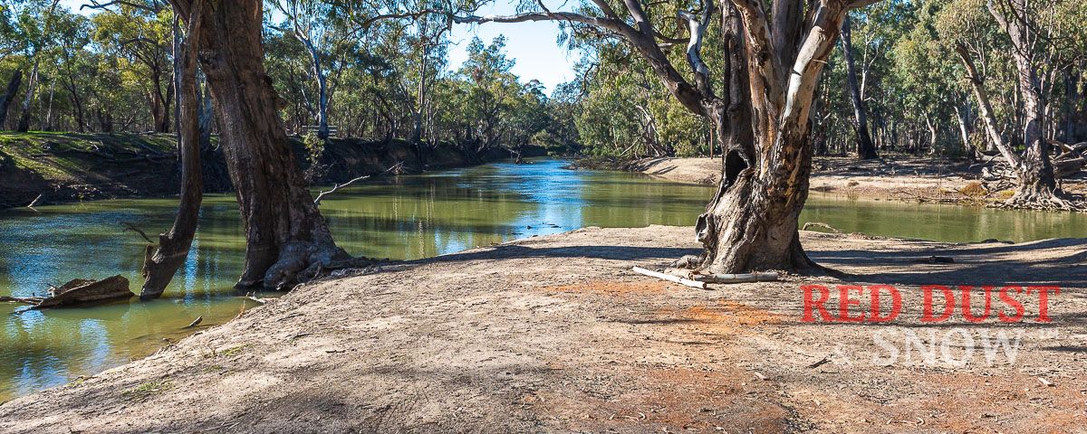 The junction of the Gulpa Creek and Edward River, north of Mathoura, NSW
While the run along the Murray River between Barmah and Picnic provides an insight into the river and forests around the Murray River, the route from Picnic Point to the junction of Gulpa Creek and the Edward River is different.
The Edward River and Gulpa Creek are anabranches of the Murray River, meaning they leave the river's course and return downstream. The Edward River flows from the Murray River upstream (north) of Picnic Point and northward, while the Gulpa Creek flows westward before heading north (due to the Cadell Fault). The two meet up 20 km to the north.
Check the Reed Beds Bird Hide along the Picnic Point Road section, just past Millewa Road.
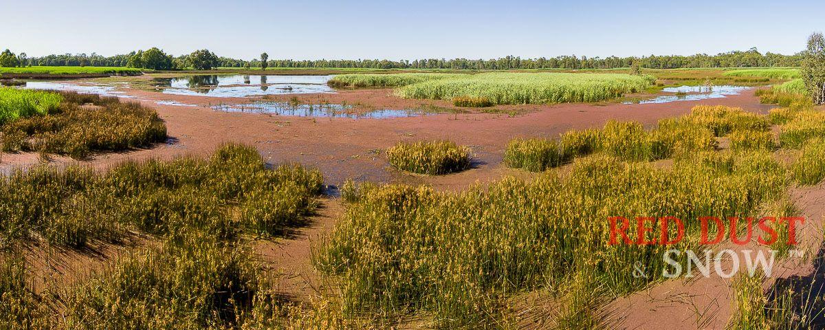 The Reed Beds Bird Hide, Mathoura, NSW, Australia.
Touring Route Description
The route along the Gulpa Creek follows this winding waterway along the Cadell Fault as it meanders northward. Along the way, there are some beautiful, secluded campsites and picnic areas to fully experience this ethereal place's wonders.
Touring Route Details:
| Road/Track | Distance (km) | Cumulative (km) | Turn | Road Type |
| Picnic Point Rd | 14.80 | 14.80 | Right | Sealed |
| Gulpa Creek Rd | 11.38 | 26.18 | Right | Gravel |
| Junction Rd* | 5.65 | 31.83 | End | Gravel |
| - | - | - | - | - |
| Junction Rd* | 5.65 | 37.48 | Right | Gravel |
| Gulpa Walliston Rd | 0.96 | 38.44 | Right | Gravel |
| Cobb Highway | 21 | 59.44 | Right | Sealed |
Turn-around room at the end of the track is good but might be a little tight for big caravans; in that case, consider the Edward-Gulpa Loop listed next, which enables camping along the way (or at Mathoura or Picnic Point) to explore the area.
The road, well maintained by National Parks, can be closed seasonally due to wet/flooding conditions.
To reach the Gulpa-Edward junction, turn right just before the Gulpa Creek Bridge and follow Junction Road (not along any of the side roads/tracks).
About Deniliquin
About Deniliquin
Deniliquin, or Deni as it is affectionately known, is a famous rural service town built around the Edward River and a series of lagoons surrounded by parkland and state forest.
Apart from the iconic Deni Ute Muster (now in its twentieth year), the town is famous for its water-based activities and being the heart of an irrigation area covering 725,000 hectares.
Agriculturally, the area produces rice, wool, beef, dairy products, wheat, barley, fat lambs, vegetables, fruit and timber.
Gulpa Creek - Edward River Loop
Gulpa Creek- Edward River Loop
This loop along the Gulpa Creek and Edwards River can be started at any point along the route and head out for a beautiful day of touring. The circuit is not long, but with a day to do it, it allows for a more relaxed way to experience the area.
At times of flooding and after heavy rains, some of this loop may be closed. (Check with Parks Office: Murray Valley National Park (See Alerts) or call NPWS Moama office on 03 5483 9100)
Touring Route Details:
| Road/Track | Distance (km) | Cumulative (km) | Turn | Road Type |
| Millewa Road | 2.21 | 2.21 | Right | Gravel |
| Picnic Point Road | 4.36 | 6.57 | Right | Sealed |
| Gulpa Creek Road | 4.01 | 10.58 | Slight Right | Gravel |
| Little Edwards Road | 0.45 | 11.03 | Right | Gravel |
| Duggans Road | 3.00 | 14.03 | Sand | |
| ** Sand Ridge Woodlands | 14.03 | |||
| Duggans Road | 3.26 | 17.29 | Left | Sand |
| Little Edwards Road | 0.43 | 17.72 | Right | Gravel |
| Gulpa Creek Road | 10.80 | 17.37 | Right | Gravel |
| Junction Road | 6.40 | 16.98 | Gravel | |
| ** Gulpa-Edward Junction | ||||
| Junction Road* | 6.40 | 23.77 | Right | Gravel |
| Gulpa Creek Road | 0.68 | 24.45 | Left | Gravel |
| Taylors Bridge Road | 4.93 | 29.38 | Right | Gravel |
| Tuppal Road | 1.24 | 30.62 | Right | Gravel |
| Edward River Road | 8.25 | 38.87 | Right | Gravel |
| Millewa Road | 0.58 | 39.45 | Right | Gravel |
Along this unique route, there are several places to see the sandhills and sand ridges that extend along the Cadell faultline, created as a result of sediment from the two ancient lakes being blown by the prevailing winds in a similar way to the Perry sandhills near Wentworth and the dunes at Lake Mungo. Of particular note, Sand Ridge Woodland, off Duggan Road, provides vehicles access to the hand ridge via maintained, sandy tracks. (Not RV friendly... and always stay on the formed roads)
Sand Ridge Woodland
The Edward River
Deniliquin - Moulamein
Deniliquin to Moulamein
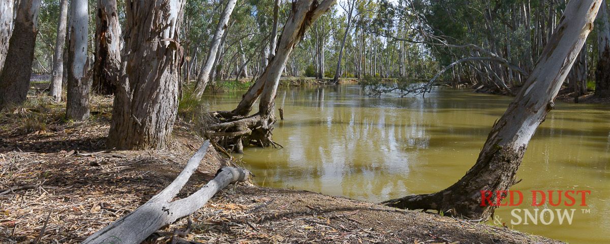
Touring Route Description
With a stopover in Deniliquin, it is time to continue the journey towards Balranald, but now we follow a very different waterway as the Edward now flows west, to the north of the Cadell Fault.
As the Edward River weaves towards the Murray River, it is joined by the Wakool and Niemur river,s as well as a few creeks.
This area is home to the Perrepa Perrepa and Wamba Wamba First Nations.
A highlight along this route is the Werai Reserve, an area that includes several of the waterways and is managed by NSW NPWS on behalf of the traditional owners.
If the roads are flooded, please use the alternative route.
Touring Route Details:
| Road/Track | Distance (km) | Cumulative (km) | Turn | Road Type |
| Wakool Rd | 11.45 | 11.45 | Right | Sealed |
| Calimo Rd | 11.70 | 23.15 | Right | Unsealed |
| Colligen Creek E Rd | 12.5 | 35.65 | Right | Unsealed |
| Old Morago Rd | 3.68 | 39.33 | Left | Unsealed |
| Finn Rd | 3.59 | 42.92 | Continue | Unsealed |
| South River Rd | 30.27 | 73.19 | Left | Unsealed |
| Balpool Rd | 35.1 | 108.29 | Right | Unsealed |
| Moulamein Rd | 1.7 | 110 | Destination | Sealed |
About Moulamein
About Moulamein
The township of Moulamein is located 373 km north of Melbourne and 70 km northeast of Swan Hill, with the Edward River flowing through the centre of town.
Debate reins about the origin of the name, with some believing it is named after the Burmese seaport of Moulmein in 1842 by an early settler to the area (Augustus Morris), while others attribute the name to a transliteration of a local indigenous word meaning 'the meeting of the waters'.
The reference to the meeting of the waters is due to the Billabong Creek flowing into the Edward River in the town. The Billabong Creek is the longest in Australia, flowing over 320 km from near Holbrook to the east.
Settled as early as 1830, Moulamein is the oldest town in the Riverina and was its administration centre as it was an important crossroad and port where the paddle steamers plying the Edward River could exchange cargo in the days when the river system was the most effective means of transport.
With the railway reaching Echuca in 1864 and becoming the most important port on the Murray River Moulamein's status as a transport hub started to decline.
Today, it is a quiet little town on the banks of the Edward River and Billabong Creek, servicing the surrounding wheat and rice-growing properties.
Moulamein - See and Do
- The Old Court House
- Old Wharf (Replica)
- Moulamein Lake
- The Old Bullock Drays
Moulamein - Kyalite & Balranald (Lake Paika)
Moulamein - Kyalite - Balranald (Lake Paika)
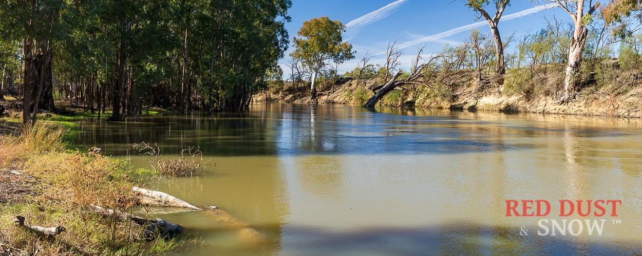 The Edward River between Moulamein and Kyalite, Murray Shire, NSW, Australia
Touring Route Description
The last section of the Timber Cutter's Run is pretty much all-sealed road, but there are still some fantastic places to access the Edward River and Wakool (which it flows into) for camping, fishing, picnicking, or just some river relaxation.
Touring Route Details:
| Road/Track | Distance (km) | Cumulative (km) | Turn | Road Type |
| Balranald Rd | 30.0 | 30.00 | Straight | Sealed |
| Kyalite Rd | 28.8 | 58.8 | Kayalite | Sealed |
| Yanga Way | 35.2 | 94 | Right | Sealed |
| Sturt Highway | 2.8 | 96.8 | Left | Sealed |
| Ivanhoe Rd | 16.5 | 113.3 | Destination | Unsealed |
About 12 km past where the Balranald Rd heads north (and you are continuing on Kayalite Rd), just before the sharp bend north (to the right), there are several access roads leading off to the south for probably the best access to the Edward, which stretches for several kilometres.
Up next is the iconic Kayalite pub, which is always well worth stopping over for refreshments, a meal, or even an overnight stay.
From Kyalite, it is a straight run along the Yanga Way to Balranald on the Sturt Highway west of Hay.
All good things must end... and with Balranald on the horizon, there is only a short 10-minute (17km) drive to our accommodation destination, the wonderful Lake Paika Accommodation.
About Balranald
About Balranald
The quiet and pretty town of Balranald is located on the Murrumbidgee River, 859 km from Sydney. Initially inhabited by the Wemba-Wemba Aboriginal group, who called the area 'Nap Nap', Balranald was probably the first town settled on the New South Wales side of the river. Balranald is now one of the major entry points to the Lake Mungo National Park and the recently opened Yanga National Park.
The population of Balranald Shire is approximately 2,500 people ,and the township has become renowned for the habitation of a frog! But not just any frog: Balranald is home to the highly endangered Southern Bell frog species (Litoria Raniformis) listed on the NSW Endangered Species List.
Gazetted a town on the 4th of April 1851, Balranald is considered the oldest settlement on the Lower Murrumbidgee.
George James McDonald, the Commissioner for Crown Lands, named the town after the place he was from, Balranald on the Isle of Uist in the New Hebrides.
The town prospered on the primary wheat, wool and red gum timber industries. Agriculture is still a decisive factor in the town's economy, with farmers now growing canola, cotton, wheat, barley, fruit, grapes and vegetables.
Balranald is a potential geographer’s living classroom. It is a pivotal place of two incredible Australian landscapes - to the east the Riverina Plain and to the west the Murray Darling Depression.
Culturally, this area is rich in both Aboriginal and European history. World Heritage Listed Mungo National Park has attracted world attention from archaeological sites containing human remains of at least 50,000 years.
Aboriginal culture is also abundant in Yanga National Park. These days, it’s a National Park that celebrates its Indigenous heritage, pastoral history and many natural wonders.
There is much to see and do in and around Balranald:
- Visit the Interpretative Pavilion,
- The Museum,
- The Old Gaol,
- The Wintong School and the Skate Park
- The Discovery Centre
- See Aboriginal Art and Craft at the Discovery Centre and The Gallery
- Visit the Art Gallery with its many exhibitions
- Walk the Heritage and Military Trails and see the Swing Bridge
- Visit the Royal Theatre
- Birdwatching enthusiasts can walk the Ben Scott Memorial Bird Trail.
- Take an Outback Geo Adventure tour to Yanga and Mungo
- Of course, Balranald also offers wonderful parks with playground equipment for those travelling with children.
- A swimming pool in the heart of town is the ideal spot to cool off in the warmer months.
- See interesting shops and enjoy the town’s restaurants and eateries
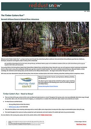
To download your copy of the Timber Cutters Brochure, please use the following link:
COMING SOON
Touring Guide is regularly updated...sign up to keep up to date to keep your map up to date!
