Darling River Tributaries
The Darling River system comprises more than ten major tributaries spanning Queensland and New South Wales. The Upper Darling (Barwon–Darling) alone covers about 13% of the Murray–Darling Basin, and key catchments including the Condamine–Balonne, Namoi, and Macquarie–Castlereagh rivers collectively drain an area equal to roughly 14% of Australia's total landmass.
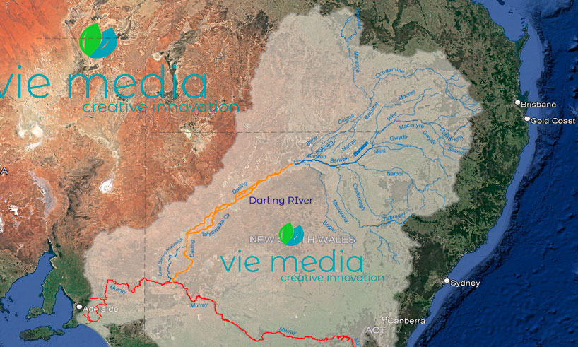
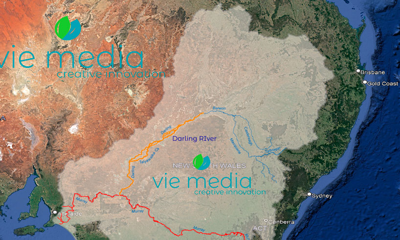
While the Darling River Run is a touring adventure along the Darling River between Walgett and Wentworth, it is beneficial to understand just how big the Darling Basin is.
The river system of the Darling consists of over ten tributaries, with the Upper Darling River (Barwon–Darling) being a complex waterway made up of many individually named waterways. The Barwon–Darling covers about 13% of the Murray–Darling Basin but only accounts for about 2.8% of the flow in the Basin. However, much more water flows through the system, with 99% of its flow generated via the upstream catchments.
The Tributaries of the Darling River
{accordion title="Darling River - The Paroo River Catchment" open="false"}
The Paroo River Catchment
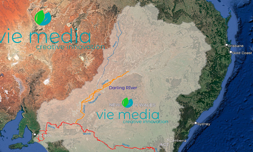
The Paroo, an ephemeral river that only flows in wet years, joins the Darling via a series of waterholes, lakes and wetlands and is the last free-flowing river in the Murray–Darling Basin.
- Catchment area: 3% of the Murray–Darling Basin
- Contribution to Basin water: 2%
- Annual streamflow: 445 GL (Calwarro gauge)
- River length: 600 km
- Towns:
- Eulo
- Hungerford
- Wanaaring
{accordion title="Darling River - The Warrego River Catchment"}
The Warrego River Catchment
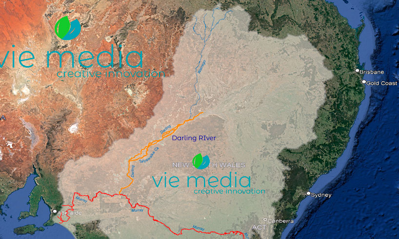
Sourcing from the Carnarvon Range in Queensland, the ephemeral Warrego River flows through flat semi-arid plains with 80% of its catchment in Queensland.
- Catchment area: 7% of the Murray–Darling Basin
- Contribution to Basin water: < 1%
- Annual streamflow: 422 GL (Wyandra stream gauging station)
- River length: 900 km
- Towns:
- Augathella
- Charleville
- Cunnamulla
- Enngonia
{accordion title="Darling River - The Condamine-Balonne River Catchment"}
The Condamine–Balonne River Catchment
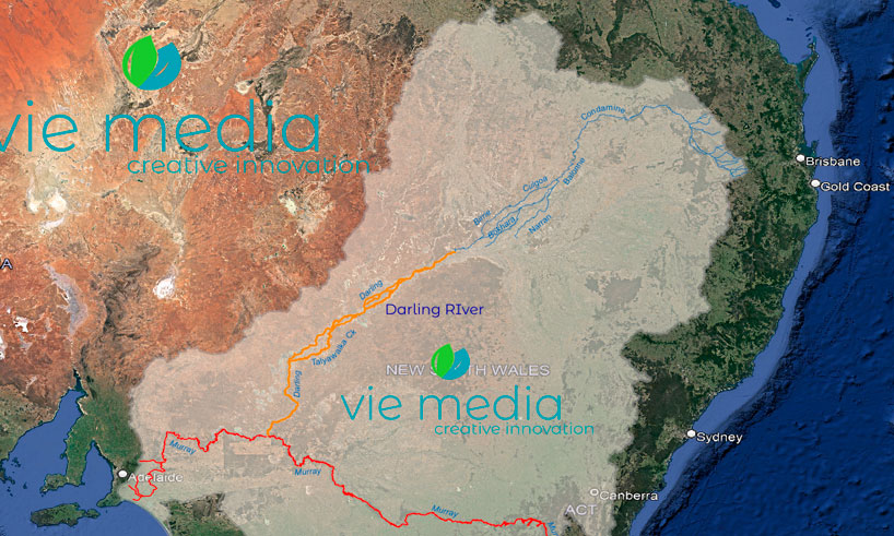
One of the largest catchments in the Murray–Darling Basin, the Condamine–Balonne catchment rivers rise from elevated areas of the Darling Downs. The Condamine is sourced from near Mt Superbus in the Main Range National Park near Warwick and becomes the Balonne near Condamine.
The Maranoa, a tributary flowing from the Carnarvon Gorge, meets the Balonne at Lake Kajarabie (Beardmore Dam) near St George, from which the Culgoa River flows southwest to join the Darling River about 20 km east of Bourke.
- Catchment area: 13% of the Murray–Darling Basin
- Contribution to Basin water: 8.5%
- Annual streamflow: 1,305 GL (St George)
- River length: 1,195 km (Condamine, Balonne and Culgoa channel)
- Towns:
- Warwick
- Toowoomba
- Dalby
- Roma
- St George
{accordion title="Darling River - The Moonie River Catchment"}
The Moonie River Catchment
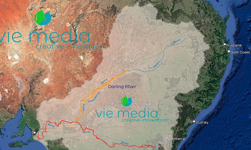
With most of its catchment (98%) in Queensland, the Moonie River flows across southwest Queensland through a very flat landscape into northern New South Wales. The Moonie is joined by thirteen minor tributaries before merging with the Barwon River, near Mungindi.
- Catchment area: 1.4% of the Murray–Darling Basin
- Contribution to Basin water: 0.8%
- River length: 542 km
- Major tributaries: Teelba Creek
- Towns include:
- Moonie
- Thallon
{accordion title="Darling River - The Border Rivers Catchment"}
The Border Rivers Catchment
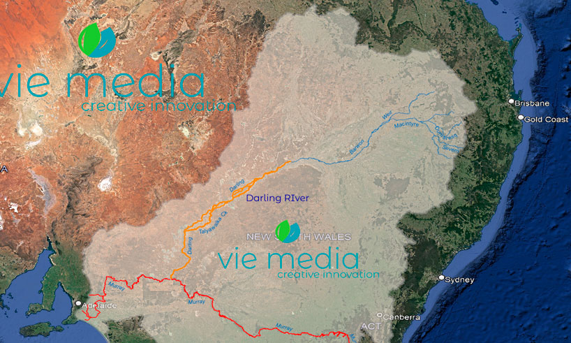
The Border Rivers is a group of rivers that straddle the New South Wales and Queensland border, with the rivers rising on the western slopes of the Great Dividing Range and running westward, gradually merging with one another to become the Barwon River on the floodplains east of Mungindi; the Barwon River flows past Walgett and Brewarrina before joining the Culgoa to become the Darling east of Bourke.
The major rivers that make up the Border Rivers are the Macintyre River, Dumaresq River and Severn River, with the Moonie River from the Downs joining the Macintyre River near Collarenebri.
- Catchment area: 4% of the Murray–Darling Basin
- Contribution to Basin water: 5%
- Annual streamflow: 130 GL (Macintyre River at Wallangra)
- Towns:
- Goondiwindi
- Stanthorpe
- Tenterfield
- Glen Innes
- Inverell
{accordion title="Darling River - The Namoi River Catchment"}
The Namoi River Catchment
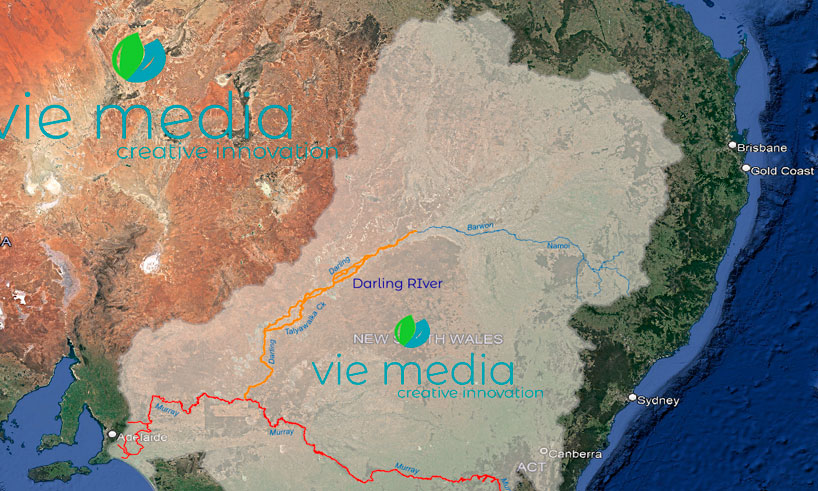
Stretching westward from the Great Dividing Range, the Namoi River flows to the floodplains of northern New South Wales via a diverse range of climates and landscapes — from cool, high-rainfall areas in the rugged terrain in the east, to semi-arid, low-rainfall areas on riverine plains in the west.
- Catchment area: 4% of the Murray–Darling Basin
- Contribution to Basin water: 3.2%
- Annual streamflow: 696 GL (Gunnedah)
- River length: 700 km
- Towns:
- Tamworth
- Gunnedah
- Narrabri
{accordion title="Darling River - The Macquarie-Castlereagh Rivers Catchment"}
The Macquarie–Castlereagh Rivers Catchment
Joining the Barwon River between Walgett and Brewarrina, the Macquarie–Castlereagh system comprises the Castlereagh, the Macquarie and Bogan rivers.
The Macquarie River rises in the Great Dividing Range near Bathurst and flows northwest through foothills and slopes past Wellington and towards Dubbo.
The Castlereagh River rises in the volcanic remnants that shape the Warrumbungle Ranges, west of Coonabarabran in northern New South Wales.
Just before the Macquarie River meets the Barwon River, the Castlereagh River joins the Macquarie River.
The Bogan River rises in the Harvey Ranges near Parkes, in central-west New South Wales, and flows north-west past Nyngan to meet the Barwon River upstream of Bourke.
- Catchment area: 7% of the Murray–Darling Basin
- Contribution to Basin water: 8.4%
- Annual streamflow: 1,175 GL (Macquarie at Dubbo)
- River lengths:
- Castlereagh River: 549 km
- Macquarie River: 960 km
- Bogan River: 590 km
- Towns:
- Coonabarabran
- Coonamble
- Bathurst
- Orange
- Dubbo
- Narromine
- Warren
- Nyngan
{/accordions}
Frequently Asked Questions
How many tributaries does the Darling River have?
The Darling River system has more than ten major tributaries. The main ones include the Paroo, Warrego, Condamine–Balonne, Moonie, Border Rivers (Macintyre), Namoi, and Macquarie–Castlereagh river systems, all of which drain large areas of Queensland and New South Wales.
What is the largest tributary of the Darling River by catchment area?
By catchment area, the Condamine–Balonne system is the largest, covering 13% of the Murray–Darling Basin and contributing 8.5% of its water. The Macquarie–Castlereagh system is also significant, covering 7% of the Basin and contributing 8.4%.
What is the last free-flowing river in the Murray–Darling Basin?
The Paroo River is the last free-flowing river in the Murray–Darling Basin. It is an ephemeral river that only flows in wet years, joining the Darling via a series of waterholes, lakes and wetlands.
Where does the Barwon River fit in the Darling system?
The Barwon River is the upper section of the Darling River. It forms from the Border Rivers (including the Macintyre) on the NSW–Queensland floodplains east of Mungindi, then flows past Walgett and Brewarrina before joining the Culgoa (from the Condamine–Balonne) to officially become the Darling River east of Bourke.
Explore the Darling River System
Understanding the tributaries brings the scale of the Darling River into focus. Plan your journey along the river with the complete Darling River Run touring guide, or discover the story of the river itself.