Outback NSW Touring Route
The Watershed Loop™
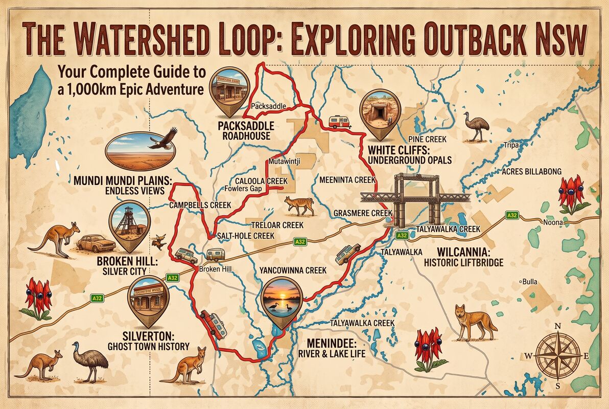
A self-drive Outback NSW touring route linking Broken Hill, the Darling River and the Corner Country while revealing the watersheds between the Murray–Darling Basin, Bulloo–Bancannia Basin and Lake Eyre Basin.
Explorer Captain Charles Sturt and others believed there was an inland sea into which the few known rivers of eastern Australia flowed. This premise was the basis of his 1844–45 expedition, and there is merit to that belief. The Watershed Loop™ is an adventure designed to show, in part, the validity of the assumption that specific waterways drained in the interior of Australia.
With Broken Hill as the ideal start and finish of this great adventure, the Watershed Loop can also be accessed from the Darling River Run at Wilcannia or Menindee, as well as when heading south from Tibooburra and Cameron Corner.
Route overview
Distance: 1,162 km
Road: Mostly unsealed, maintained roads.
Provisions: Broken Hill, Packsaddle, White Cliffs, Wilcannia and Menindee.
Understanding the watershed
The Watershed Loop follows country where the Barrier Ranges form the western extent of the Darling River basin watershed, then moves across the boundaries of the Lake Frome, Bancannia and Paroo River catchments.
The Barrier Ranges, sometimes referred to as the Barrier Range, were initially named Stanley's Barrier Range by Sturt in honour of Lord Stanley. Captain Charles Sturt named it for the perceived barrier it created to his expedition. More importantly, it forms the western extent of the Darling River basin watershed, a subdivision of the Murray–Darling Basin.
The Barrier Ranges comprise:
- Coko Range
- Floods Range
- Slate Range
- Robe Range
- Mundi Mundi Range
- Coonbaralba Range
- Mount Darling Range
To the northwest of the watershed is the Bulloo–Bancannia Basin, Australia's second-largest endorheic basin: a basin that retains water and allows no outflow to other external bodies of water. It has an area of 98,820 km². The Lake Eyre Basin is Australia's largest endorheic basin.
The basis of this tour, as its name suggests, is to experience the watersheds that Sturt and others believed existed and that formed the theory of the inland sea.
- Murray–Darling Basin: Paroo River Catchment, a Murray–Darling tributary
- Bulloo–Bancannia Basin: Lake Bancannia
- Lake Eyre Basin: Lake Frome
In 1840, Edward John Eyre was the first European to lay eyes on the 9,500-square-kilometre lake that now bears his name, in one of the driest desert regions of South Australia.
Sturt, and those who commissioned him, did not know there would be an inland sea, and that was not the premise of his endeavours. The expedition intended to discover what was beyond the Murray–Darling western catchment. They knew the Darling Catchment drained to the east; the watershed beyond Stanley's Barrier Ranges could reveal where the adjacent catchment flowed.
Watershed elevation profiles
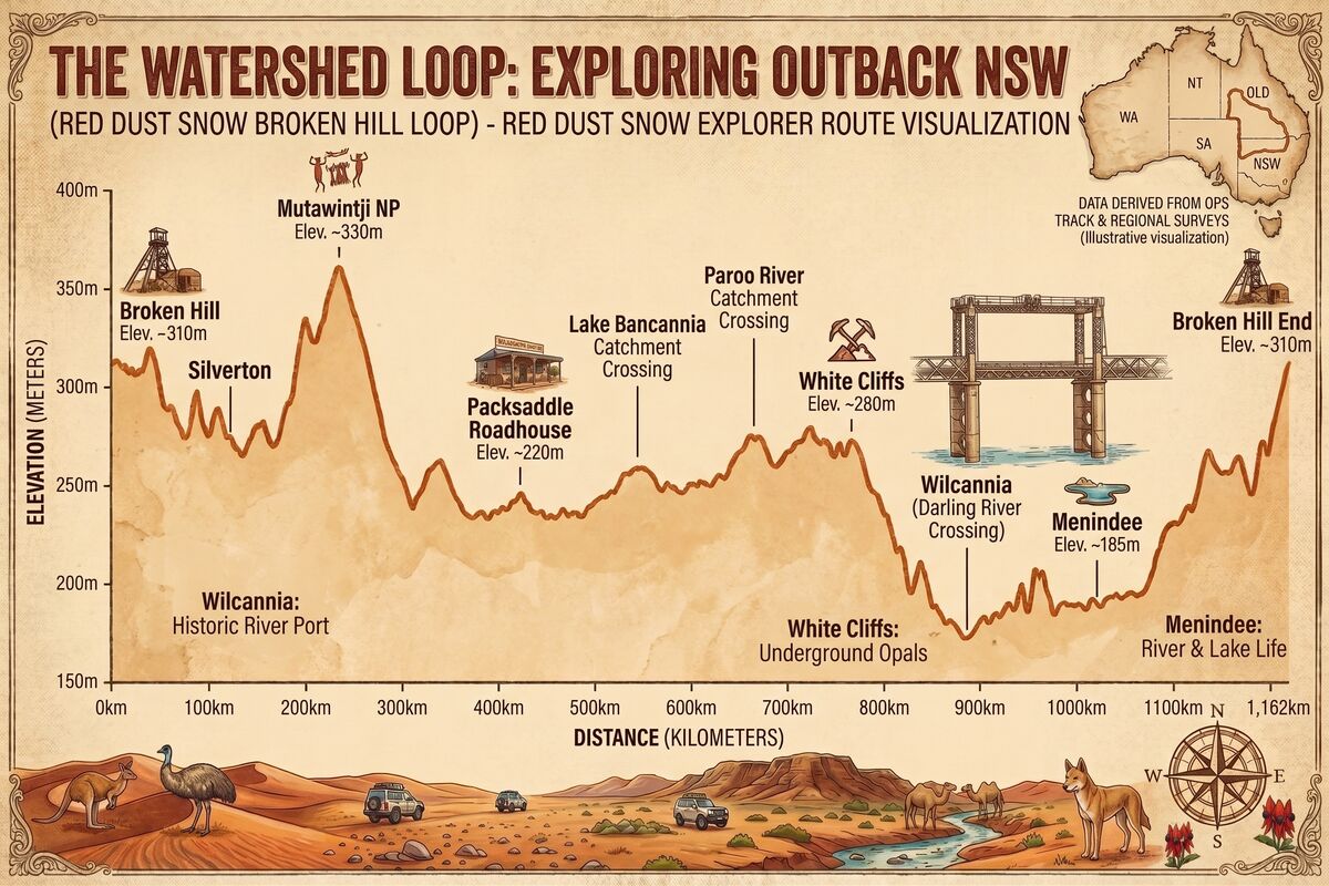
Outback NSW is often regarded as very flat country, but the elevation profile shows that this touring route crosses real elevation changes between the catchments, allowing the individual basins to work.
Of particular note:
- Across the 1,165 km Watershed Loop, net elevation gain and loss is 1,895 m. The highest point is 333 m near Mt Gipps Station, while the lowest point is 58 m at Tandou Lake and Redbank Creek. Redbank Creek is a tributary of the Great Darling Anabranch.
- The route also passes the highest point of the Barrier Ranges, Mount Robe at 459 m, northeast of Eldee Creek.
- Broken Hill is in the Darling Catchment, part of the Murray–Darling Basin, and the route crosses into the Lake Frome Catchment, part of the Lake Eyre Basin, near Silverton.
- The Lake Bancannia Catchment is crossed north of Mutawintji National Park and exited on the section to White Cliffs, where the route enters the Paroo River Catchment, part of the Murray–Darling Basin.
Note: The creeks listed in the route guide are ephemeral: they flow intermittently after sufficient rain. They are included as an insight into the hydrology of the catchments.
Watershed Loop route guide
The loop is divided into eight sections, beginning and ending at Broken Hill. Road conditions can change after rain; check local conditions and ensure the route is suitable for your vehicle before travelling.
1. Broken Hill to Eldee Station
The first section travels from Broken Hill through Silverton and Mundi Mundi Plains to Eldee Station, crossing from the Darling Catchment into the Lake Frome Catchment and following the Barrier Ranges.
Section overview
- From Broken Hill Outback Resort, it is a short 15 km trip into Broken Hill along the Barrier Highway, with time for more sightseeing and provisions.
- Eldee Station is less than one hour from Broken Hill. After exploring Silverton, the route heads west across Umberumberka Creek and One Mile Creek into the Lake Frome Catchment and Mundi Mundi Plains.
- North along the Barrier Ranges, past Umberumberka Reservoir, the route crosses predominantly west-flowing Umberumberka Creek, Rockhole Creek, Mundi Mundi Creek and Eldee Creek.
Section detail
- Distance: 70 km
- Road: Sealed to Broken Hill and Silverton; unsealed to Eldee Station
- Provisions: Broken Hill
- Route: Barrier Highway to Broken Hill, Silverton Road to Silverton, Wilangee Road past Mundi Mundi, then Eldee Station
2. Eldee Station to Mt Gipps Station
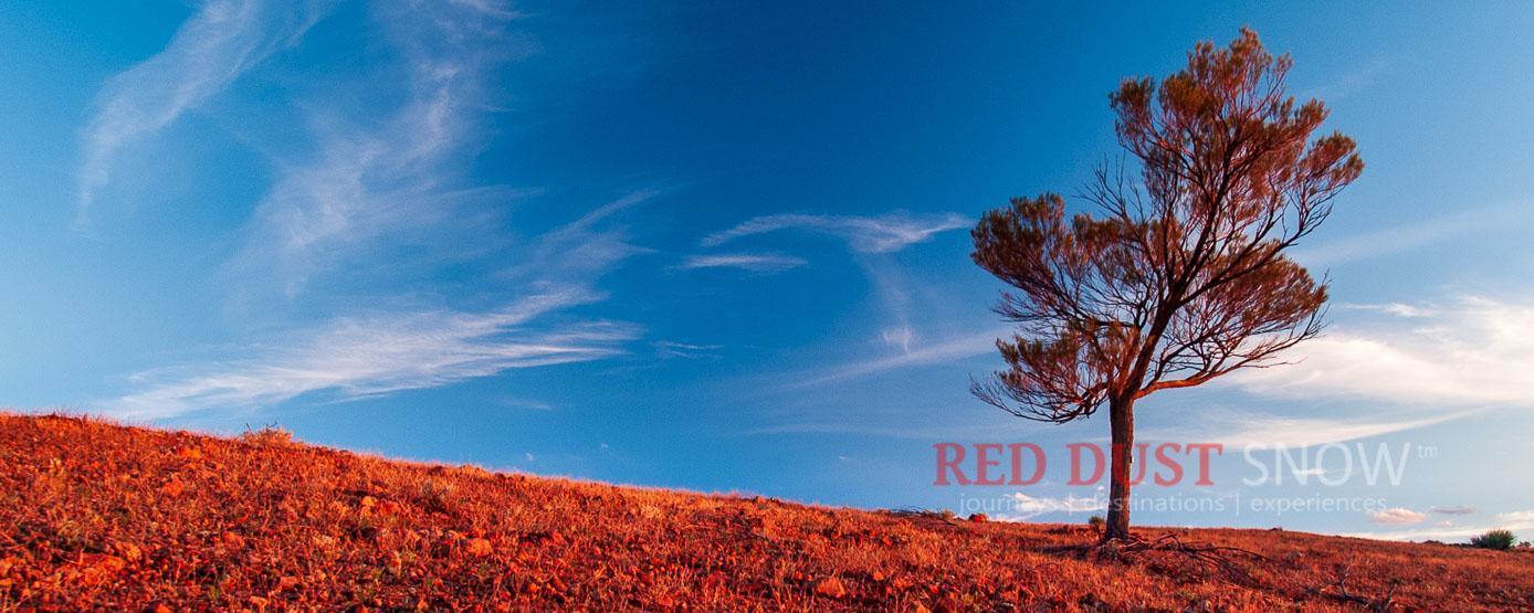
From Eldee Station, the route follows the western side of the Barrier Ranges, passes Mount Robe and then turns through Corona Hills towards Mt Gipps Station.
Section overview
- Heading north from Eldee Station, within the Lake Frome Catchment, the route tracks along the western side of the Barrier Ranges.
- Not far from Eldee, Mount Robe, the highest peak of the Barrier Ranges, can be seen on the right. The route crosses Little Aller, Big Aller, Cartwrights, Soapstone, Smiths, Campbells, Tarltala and Willurrawa creeks.
- The route then heads west to Corona Hills before turning southeast west of Byjerkerno Ridge, crossing Morphett, Willowurrawa, Alberta, Poison, Campbells, Spring and Jones creeks.
Section detail
- Distance: 115 km
- Road: Unsealed to Mt Gipps Station
- Provisions: None
- Route: Wilangee Road to Mount Woowoolahra Road, Mount Woowoolahra Road to Corona Road, then Mt Gipps Station
3. Mt Gipps Station to Packsaddle
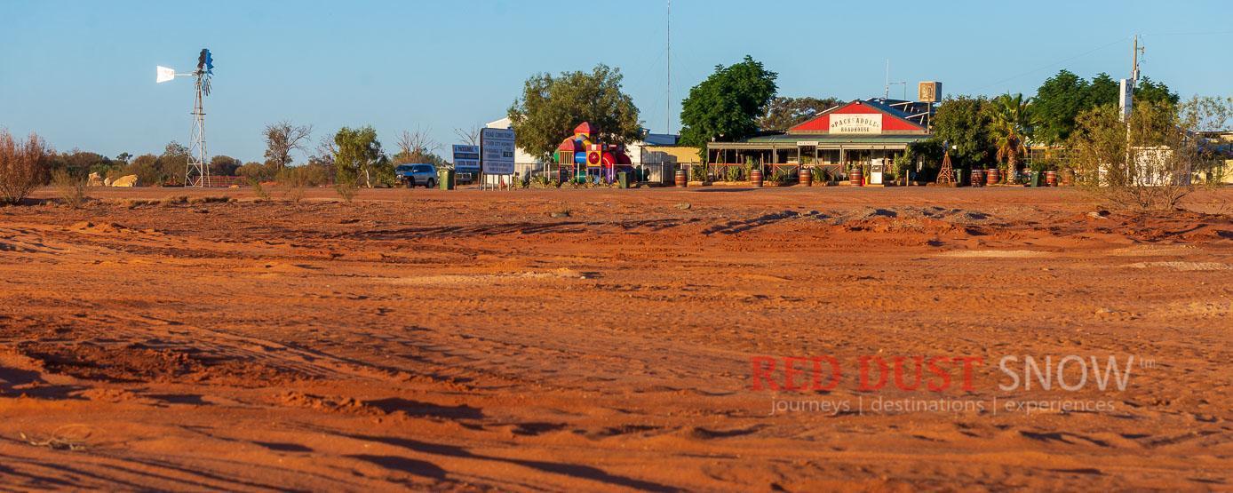
This long section runs through the Darling Catchment, Mutawintji country and the Bancannia Catchment before joining the Silver City Highway near Packsaddle.
Section overview
- Leaving Mt Gipps Station south along Corona Road, the route crosses Dead Creek and Yancowinna Creek in the Darling Catchment.
- Heading north on the Silver City Highway to the Mutawintji National Park turn-off, the route crosses Salt Hole Creek, Smiths Well Creek and Treloar Creek. Along Mutawintji Road it crosses Gairdners Creek several times before the Visitor Centre turn-off.
- Continuing north, the route leaves the Darling Catchment for the Bancannia Catchment, a division of the Bulloo–Bancannia Basin.
- Heading northeast, the route crosses Mount Wright, Old Coonigans, Noonthorangee, Ten Mile, Tekum and Kayrunnea creeks.
- On Henry Roberts Road towards the Silver City Highway, creeks crossed include Kayrunnera, JK, Morden, Funeral, Ponto and Palgamurtie creeks.
- From the Tool Tree intersection, the final section heads south across Wonnaminta, Box Holes, Barons and Packsaddle creeks.
Section detail
- Distance: 340 km
- Road: Mostly unsealed
- Provisions: Packsaddle Roadhouse
- Route: Mt Gipps to Mutawintji NP: 107 km; Mutawintji NP to Packsaddle: 233 km, via Waterbag Road, Mutawintji Road, Kayrunnera Road, Henry Roberts Road and the Silver City Highway.
4. Packsaddle Roadhouse to White Cliffs
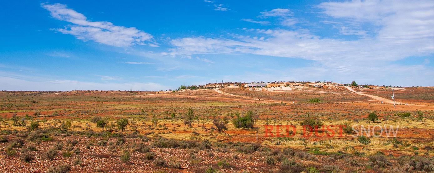
From Packsaddle to White Cliffs, the route traverses the southern Bancannia Catchment before entering the Paroo River Catchment, a division of the Murray–Darling Basin.
Section overview
- After 12 km south on the Silver City Highway, the route turns east along Wonnaminta Road towards Henry Roberts Drive, passing Nundora Creek and crossing Conns, Wonnaminta and Morden creeks.
- Back on Henry Roberts Road, heading southeast, the route crosses Turkey Creek, Williams Creek and Yanda Watercourse.
- Shortly before White Cliffs, the route enters the Paroo River Catchment, indicated by the southwest-flowing Bunker Creek, a tributary of the lower Paroo River. South of White Cliffs, the route crosses Bunker Creek again.
Section detail
- Distance: 173 km
- Road: Mostly unsealed
- Provisions: Packsaddle Roadhouse and White Cliffs
- Route: Silver City Highway, Wonnaminta Road, Henry Roberts Road, Whipstick Road, then White Cliffs Hotel
5. White Cliffs to Wilcannia
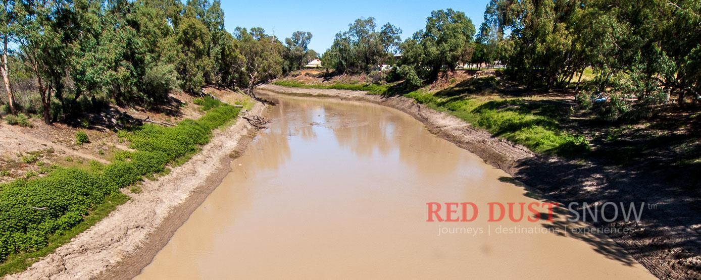
The sealed road from White Cliffs to Wilcannia crosses Chinamans Creek and Bunker Creek before reaching the Darling River.
Section detail
- Distance: 96 km
- Road: Sealed
- Provisions: White Cliffs and Wilcannia
- Route: Opal Miners Way, then Barrier Highway/A32
6. Wilcannia to Nelia Gaari Station
The journey along the Darling River provides a contrast to the watersheds travelled so far, following Australia's third-longest river and introducing the Darling River Run.
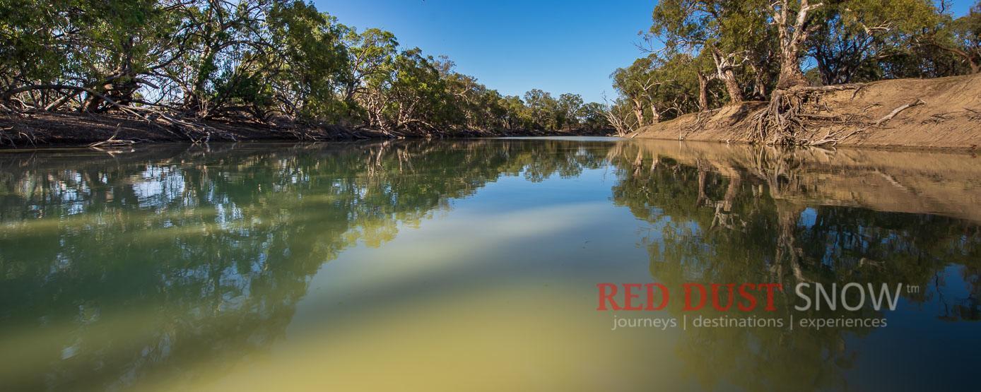
The next two sections provide an introduction to the Darling River Run, a highly regarded touring route along one of Australia's most iconic waterways. The route to Nelia Gaari Station is along the western side of the river; access to the station is not possible from the other side.
Section detail
- Distance: 88 km
- Road: Unsealed
- Provisions: Wilcannia
- Route: Barrier Highway, Reid Street, West Wilcannia Road, then Nelia Gaari Station
7. Nelia Gaari to Menindee and Bindara Station
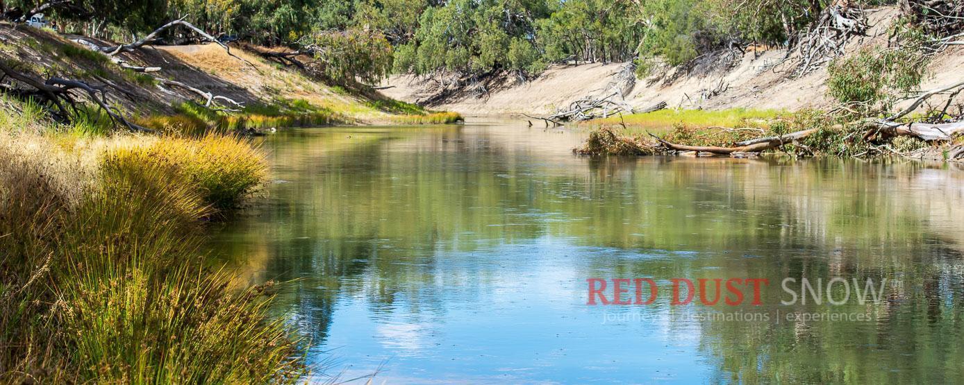
South of Nelia Gaari, the route follows the western side of the Darling River past a succession of ephemeral lakes, through Menindee and on to Bindara Station.
Section overview
- Shortly after leaving Nelia Gaari, the route passes Malta Lake, Balaka Lake, Tandure Lake, Lake Pamamaroo, Lake Menindee, Lake Cawndilla and Lake Tandou.
- Lake Tandou is the lowest point of the touring route at 58 m.
- Kinchega National Park is regarded by many as one of the best places to experience the Darling River and is worth visiting before heading to Bindara Station.
Section detail
- Distance: 160 km
- Road: Unsealed
- Provisions: Menindee
- Route: West Wilcannia Road, Menindee Road, Little Menindee Creek Road and Old Pooncarie Road to Bindara Station
8. Bindara Station to Broken Hill
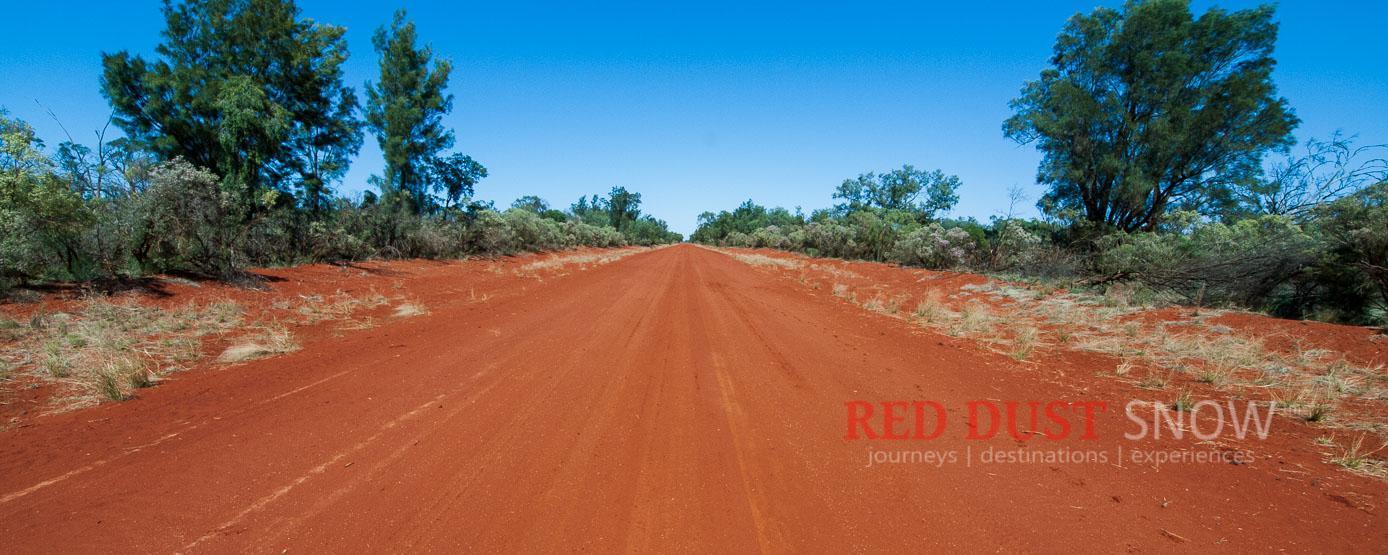
From Bindara Station, return to Broken Hill or extend the adventure along the Darling River Run, towards Cameron Corner, or through Lake Mungo country.
Section detail
- Distance: 175 km
- Road: Unsealed and sealed
- Provisions: Broken Hill; Menindee if required by backtracking
- Route: Old Pooncarie Road, Tandou Road, Silver City Highway/B79 and Barrier Highway/A32 to Broken Hill Outback Resort
Towns, parks and localities
About the Darling River
The Darling River is Australia's most iconic river and, when combined with its longest tributaries, creates Australia's longest waterway, stretching from Queensland's Darling Downs across Outback NSW to its meeting with the Murray River at Wentworth in southwest New South Wales.
Part of the Murray–Darling Basin, which covers 1,061,469 square kilometres, the Darling River rises from Queensland's Darling Downs and New South Wales's northern rivers region. Its system is sourced primarily from the subtropical summer rains of southeast Queensland, while the Murray River receives flow from snowmelt in the New South Wales and Victorian alpine region.
About Broken Hill
Broken Hill is a true outback icon, sitting on an iron-rich red landscape under a big azure sky. The colours and contrasts are synonymous with Australia's Corner Country and the area radiating out from Cameron Corner, where NSW, Queensland and South Australia meet.
While Bourke grew out of river trade, Broken Hill grew out of mining and iron and is where the Big Australian, BHP, was born. The Heritage-listed city has a big history, wonderful attractions and unique experiences.
About Mutawintji National Park
This route takes in Mutawintji National Park and its evocative historic site, where access is guided only. Mutawintji is one of the most moving and culturally significant areas of New South Wales. Its sandstone ridges and gorges create a powerful sense of the land and its Indigenous cultural significance.
About White Cliffs
White Cliffs is one of the truly must-see outback destinations. It is Australia's oldest opal field, discovered by chance in the 1880s by kangaroo shooters. The town is where the Australian opal industry began; its population peaked at around 5,000 in the late 1890s and is now around 200.
An excellent 92 km sealed drive along the Opal Miners Way from Wilcannia brings visitors to this unique place. For travellers who prefer the road less travelled, the dry-weather gravel loop through Mutawintji National Park and White Cliffs is a rewarding drive.
About Wilcannia
Wilcannia is a Darling River town on the Barrier Highway between Cobar and Broken Hill, and a largely undisturbed former port. Its architecture rewards a stop, while White Cliffs is about an hour north by sealed road.
At the junction of a major east–west highway and the Long Paddock, Wilcannia is an excellent access point for the Darling River Run. Tilpa lies upstream; Menindee and the Menindee Lakes lie downstream.
About Menindee and Kinchega National Park
Menindee and the Menindee Lakes are a central Darling River destination, offering access to the river, the lakes and Kinchega National Park. Kinchega provides access for birdwatching, river camping, fishing, natural history and Aboriginal and pastoral heritage.
Watershed Loop FAQs
What is the Watershed Loop?
The Watershed Loop is a self-drive Outback NSW touring route that begins and ends in Broken Hill. It travels through the Barrier Ranges, Mutawintji country, Packsaddle, White Cliffs, Wilcannia, Menindee and the Darling River country, revealing the waterways and divides between the Murray–Darling Basin, Bulloo–Bancannia Basin and Lake Eyre Basin.
How long is the Watershed Loop?
The published route distance is approximately 1,162 km, although the elevation notes in this guide refer to 1,165 km. Allow for route variations, side trips, accommodation choices and changing road conditions when planning your journey.
Where does the Watershed Loop start and finish?
Broken Hill is the ideal starting and finishing point for the Watershed Loop. The route can also connect with the Darling River Run at Wilcannia or Menindee, and can be incorporated into a wider Corner Country journey when travelling south from Tibooburra or Cameron Corner.
Do I need a 4WD for the Watershed Loop?
The route uses mostly unsealed, maintained roads, with some sealed sections. Vehicle suitability depends on current road conditions, weather, local access requirements and the side trips you choose. Check conditions before leaving, avoid unsealed roads after rain when they are closed or unsuitable, and travel in a vehicle appropriate for remote Outback NSW roads.
How many days should I allow for the Watershed Loop?
Allow several days to enjoy the Watershed Loop rather than treating it as a single long drive. The route includes Broken Hill, Silverton, Eldee Station, Mutawintji National Park, Packsaddle, White Cliffs, Wilcannia, Menindee, Kinchega National Park and the Darling River, with accommodation, walking, photography and local exploration opportunities along the way.
What are the main catchments crossed by the Watershed Loop?
The Watershed Loop links three major waterway systems: the Murray–Darling Basin, including the Darling and Paroo River catchments; the Bulloo–Bancannia Basin, including the Lake Bancannia catchment; and the Lake Eyre Basin, including the Lake Frome catchment. The route is designed to make these landscape and drainage transitions visible to travellers.
When is the best time to tour Outback NSW and the Corner Country?
Cooler months are generally more comfortable for touring Outback NSW and the Corner Country, while summer heat can be extreme. Regardless of season, check local road reports, park alerts, fuel availability, weather forecasts and accommodation arrangements before travelling. Unsealed outback roads can change quickly after rain.
What should I prepare before travelling in Outback NSW?
Plan fuel, water, food, accommodation and communications before setting out. Carry enough drinking water and supplies for the distance and conditions, tell someone your travel plans, download or carry reliable maps, and check road, weather and national park information close to departure. Distances are large and services can be limited between towns and roadhouses.